Tag: From Asakusa

Places that are easy to reach from Asakusa.

  • Ueno Park History Walk, Part 2: From Battlefield to Museum Hill, with Le Corbusier

    Ueno Park History Walk, Part 2: From Battlefield to Museum Hill, with Le Corbusier

    This post contains affiliate links. If you book through them, I may earn a small commission at no extra cost to you.

    In Part 1 we walked the south side of Ueno Park: the shoguns’ temple of Kan’ei-ji, the Battle of Ueno in 1868, and the racecourse around Shinobazu Pond. We ended with a question. The battle left most of the hilltop in ashes, so what happened to all that empty land?

    The answer is all around you on the north side of the park. In about 150 years, the burned temple grounds became Japan’s greatest museum quarter: the Tokyo National Museum, the National Museum of Nature and Science, and the National Museum of Western Art, Le Corbusier’s only building in Japan. Along the way we will meet a Dutch doctor with the wrong face, a ghost station built with the Emperor’s permission, and, at the end, a bridge where the ancient seashore meets Tokyo’s busiest railway lines.

    Quick facts

    RouteJR Ueno (Park Exit) → Tokyo Bunka Kaikan → National Museum of Western Art → National Museum of Nature and Science → Bauduin statue → fountain square → Tokyo National Museum → old Hakubutsukan-Dobutsuen Station and Sogakudo → Kan’ei-ji main hall → Ryodaishi Bridge
    DistanceAbout 2 km, mostly flat
    Time1.5 hours outside only, or a full half day with one museum
    CostWalking is free, and so are the Rodin sculptures outside the National Museum of Western Art. Tokyo National Museum collection: ¥1,000. Western Art permanent collection: ¥500 (¥1,000 from 20 March 2027)
    AvoidMondays: the main museums are closed
    Nearest stationsStart: JR Ueno, Park Exit. Finish: JR Ueno or JR Uguisudani

    Start: the Park Exit

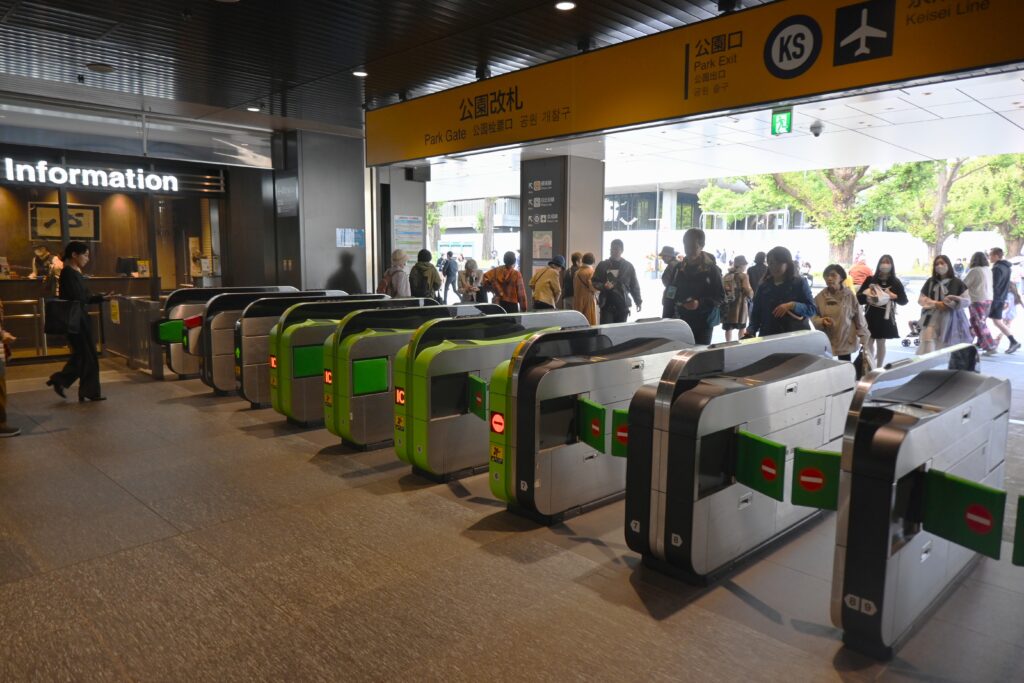
    JR Ueno Station’s Park Exit (Koen-guchi) is the front door of the museum quarter. As soon as you walk out of the ticket gates, the National Museum of Western Art is on your left and the Tokyo Bunka Kaikan concert hall on your right, with the zoo and the museums beyond.
    The Tokyo Bunka Kaikan, opened in 1961, is the work of Kunio Maekawa, one of Le Corbusier’s Japanese students. It faces his teacher’s museum across the square, which is a nice way to begin. Note that the hall is closed for major renovation from May 2026 until some time in fiscal 2028, so for now you can only see it from outside.
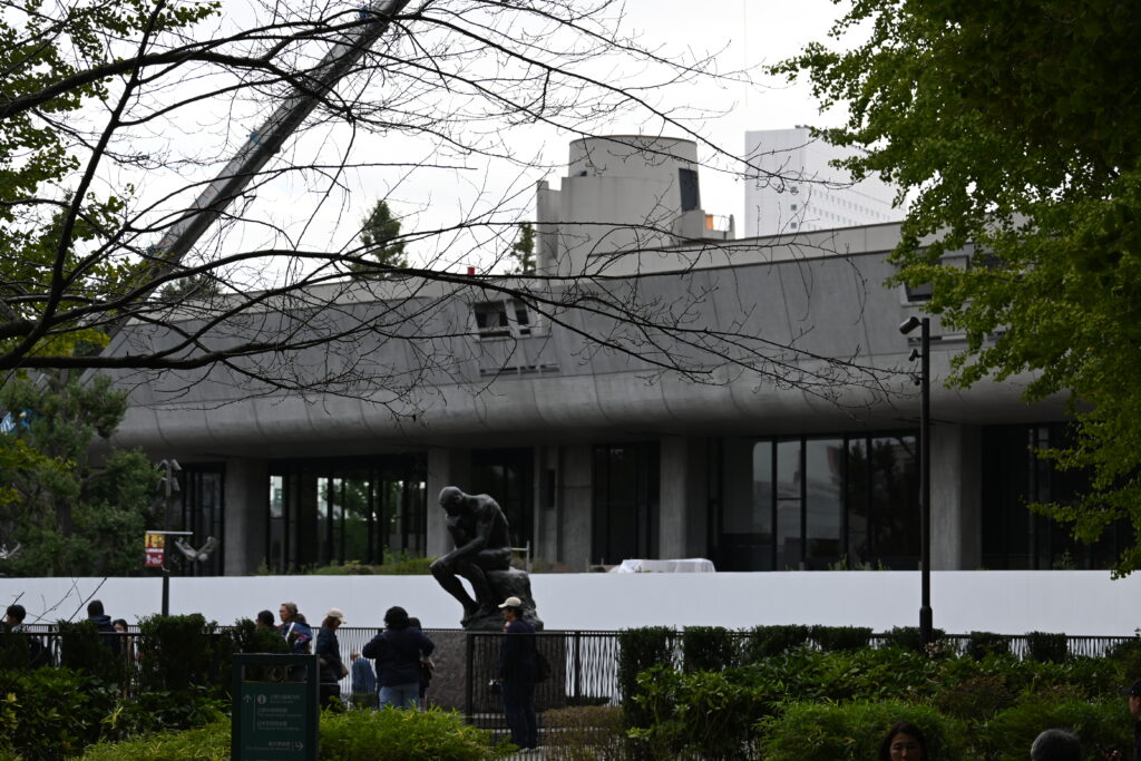
    Le Corbusier’s museum: the National Museum of Western Art

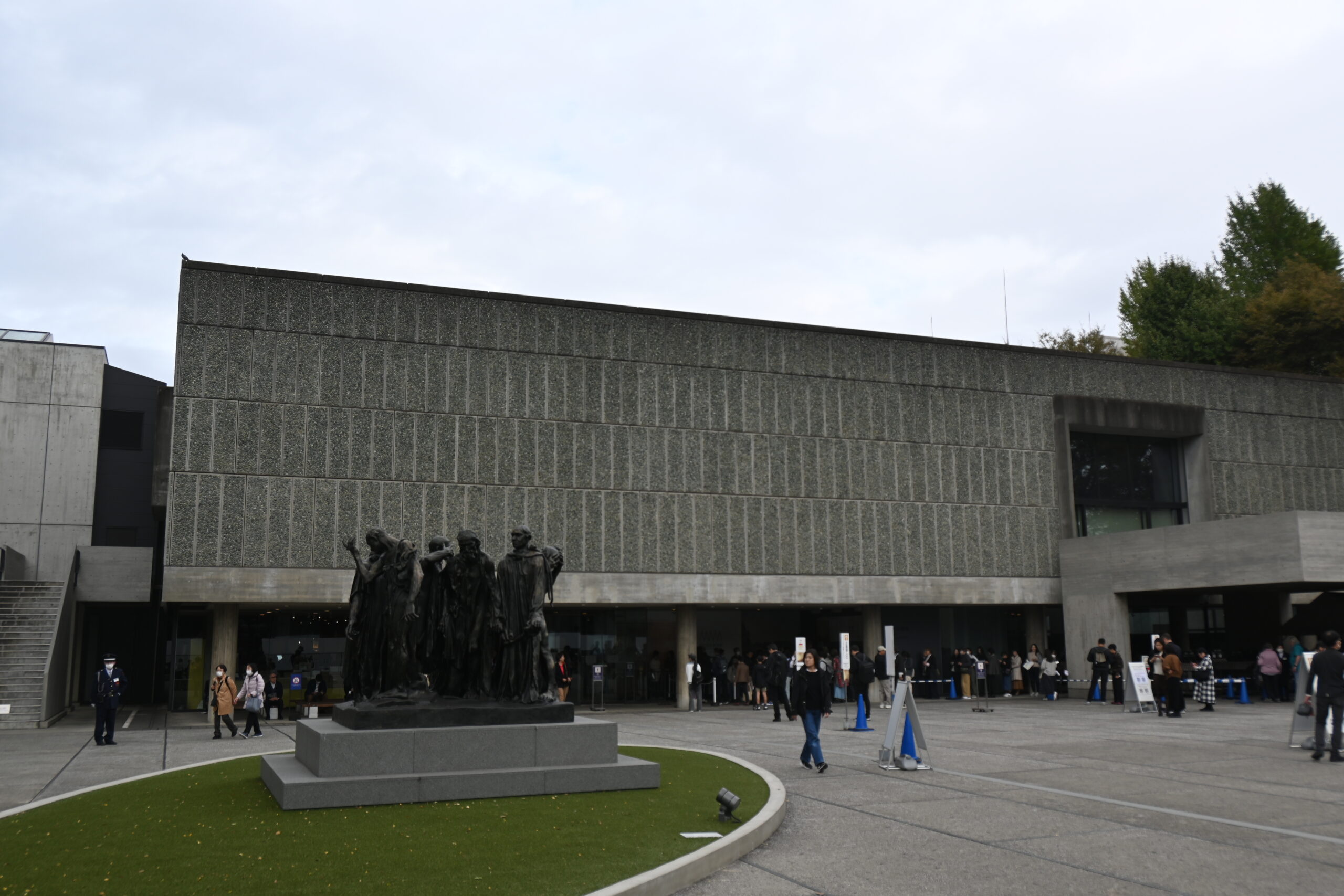
    The National Museum of Western Art opened in 1959. Its story begins with a businessman, Matsukata Kojiro, who collected thousands of European paintings and sculptures in the early 20th century. Part of his collection stayed in France and was held by the French government after the Second World War. When France agreed to return many of the works to Japan, Japan promised to build a museum for them, and Le Corbusier was chosen to design it. His Japanese students, Maekawa Kunio, Sakakura Junzo and Yoshizaka Takamasa, finished the drawings and supervised the work.
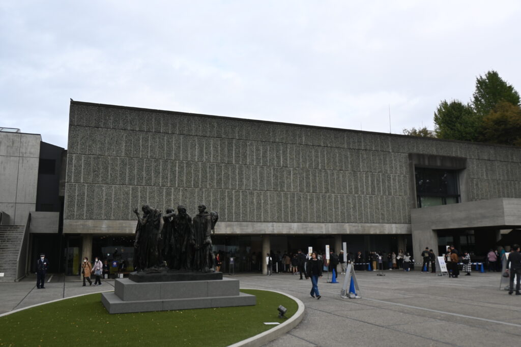
    At first sight it is a plain box. But look at how it stands. The ground floor is lifted on columns, with open space underneath: Le Corbusier called these columns pilotis. Inside, the galleries wind around a central hall in a square spiral. His idea was a “museum of unlimited growth”, which could keep expanding outward like a snail shell as the collection grew. In 2016 the building became a UNESCO World Heritage Site, as one of 17 works by Le Corbusier in seven countries listed together.
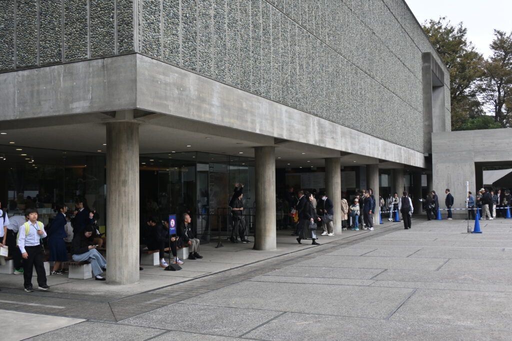
    On my visit, the special exhibition was so crowded that I could not get in. Many visitors seemed to have come for the World Heritage building as much as the art. But I have been here many times before, and I can say this: the permanent collection is wonderful, and a bargain. Look for El Greco, Monet and Renoir. Adults pay ¥500, university students ¥250, and high school students and younger are free. From 20 March 2027 the price for adults rises to ¥1,000 and for students to ¥500, still very reasonable.

    Rodin in the front garden, free

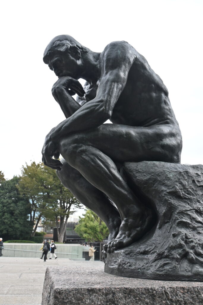
    You do not need a ticket for the best-known works. In the front garden stand Rodin’s The Gates of Hell and The Thinker.
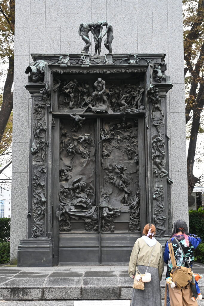
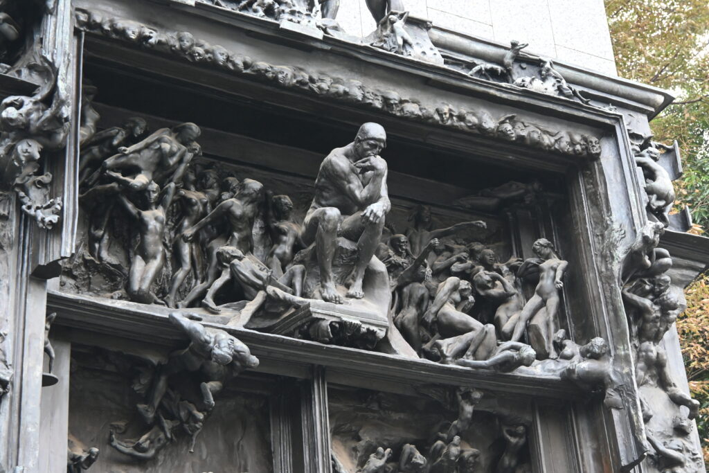
    Find the small seated figure above the doors. Rodin first made The Thinker as part of this gate, looking down on the souls below, before he enlarged it as a separate statue. Then walk over to the big Thinker, which you can see from very close. Look carefully at his pose: he rests his right elbow on his left thigh. Try it yourself. It is surprisingly uncomfortable! Then look at his feet. His toes are curled and gripping the stone, as if his whole body is working, not only his head.
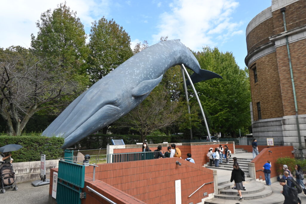
    A whale and a rocket launcher: the National Museum of Nature and Science

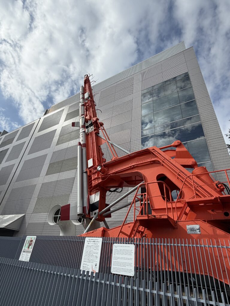
    Next door is the National Museum of Nature and Science, founded in 1877, Japan’s main museum of natural history and science. Even from outside there are two things to see. One is a life-size model of a blue whale, about 30 meters long, diving beside the entrance. The other is a big red launcher. It is not a rocket, but the real launch rail used for the Lambda rocket that put Japan’s first satellite, Ohsumi, into orbit in 1970, from Uchinoura in Kagoshima Prefecture.
    Why is this a park? Thank a Dutch doctor

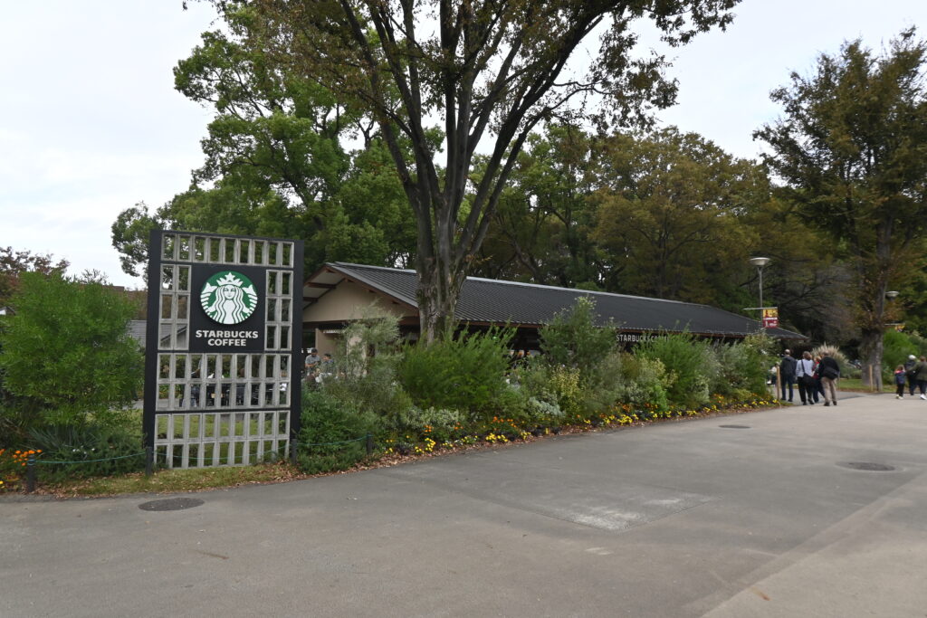
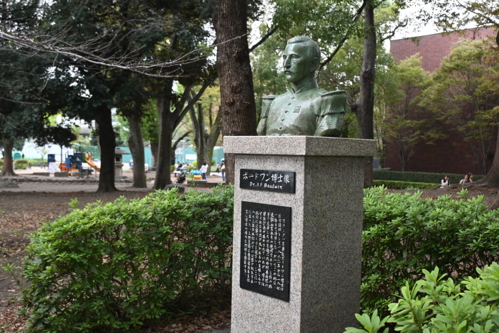
    Walk on toward the fountain. Past the Starbucks, at the back on the right, stands a small bust that most visitors walk straight past. This man is the reason Ueno Park exists.
    After the Battle of Ueno, the new government planned to build a medical school and hospital on the burned hilltop, and work had already started. In 1870, the Dutch army doctor Anthonius Bauduin, who was teaching medicine in Japan, was shown the site. He told the Japanese officials that it would be a waste to cut down the trees, and that Ueno should become a park, like the great parks of European cities. The medical school was moved to Hongo instead, and became the University of Tokyo. In 1873 Ueno was named one of Japan’s first public parks, together with Asakusa, Shiba, Fukagawa and Asukayama, and it opened officially in 1876. Without Dr. Bauduin, Ueno might be a university campus today.
    The wrong face, again

    Remember Saigo Takamori’s statue in Part 1, whose widow said, “My husband was not like this”? Ueno has a second face problem. When Bauduin’s bust was first put up in 1973, the family had supplied a photograph of the wrong man, his younger brother, who had been the Dutch consul in Japan. Nobody noticed for decades. In 2006 the bust was finally replaced with the right face. So if you want to see the real Dr. Bauduin, you are just in time.

    The fountain square: a temple, then a world fair

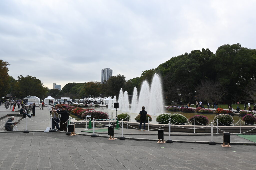
    The big fountain square is the heart of the park. Look back at Hiroshige’s view of Kan’ei-ji in Part 1: the great main hall of the temple stood right here. After the battle, this empty ground became the stage for modern Japan.
    In 1877 the government held the First National Industrial Exhibition here, a Japanese world fair to show off new machines, crafts and products. Kawanabe Kyosai’s print from that year shows Ueno full of flags, halls and visitors, with a tall windmill turning above the pines. Only ten years earlier this was a temple ground where the shoguns came to pray.
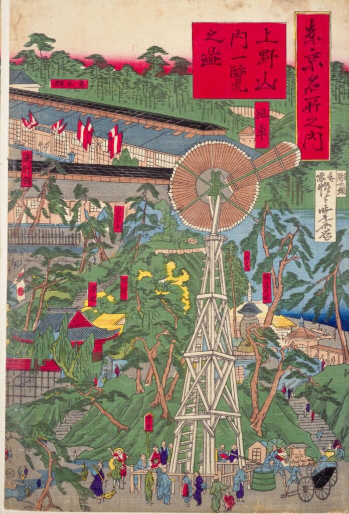
    Exhibitions kept coming back to Ueno, and the museums grew out of them. That is why so many museums stand side by side here today.

    The Tokyo National Museum

    At the end of the fountain square stands the Tokyo National Museum, Japan’s oldest museum, founded in 1872. Its collection of Japanese and Asian art is one of the largest in the world, with many National Treasures.
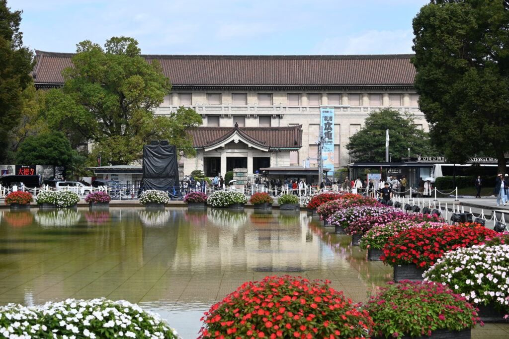
    Then and now: two main buildings

    The building you see today is not the first. In 1881 the British architect Josiah Conder, the “father of modern Japanese architecture”, designed a red-brick gallery for the Second National Industrial Exhibition. When the exhibition closed, it became the museum’s main building. Yoshu Chikanobu printed it in 1881, with fashionable ladies strolling in front. That brick hall was badly damaged in the Great Kanto Earthquake of 1923.
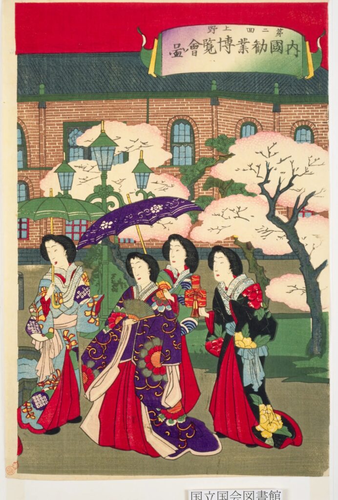
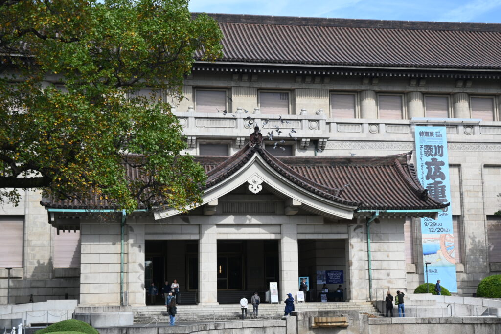
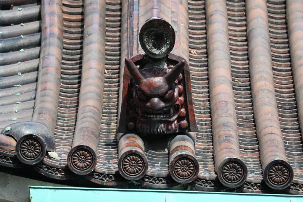
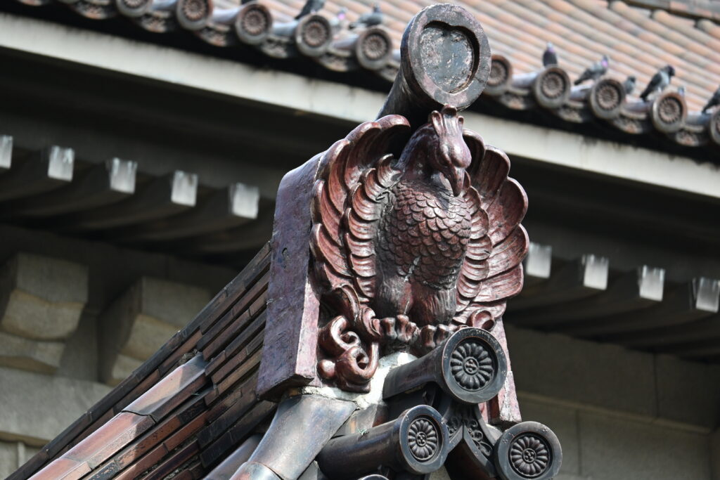
    What stayed the same: the place, and the idea of a grand building to show Japan’s treasures. What changed: the style. The present main building, completed in 1938, is a Western-style concrete building wearing a heavy Japanese tiled roof, a style popular in 1930s Japan. Look up at the roof: you will find onigawara demon tiles and phoenix ornaments, traditionally meant to keep away evil and bring good fortune.
    Inside the main building

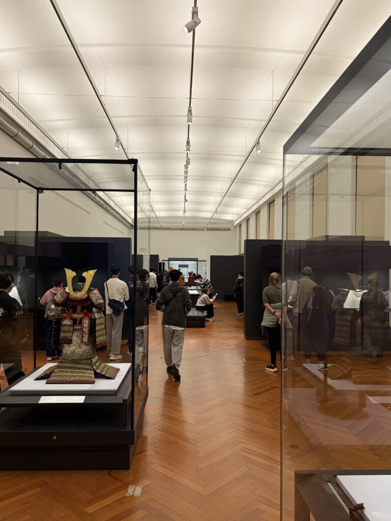
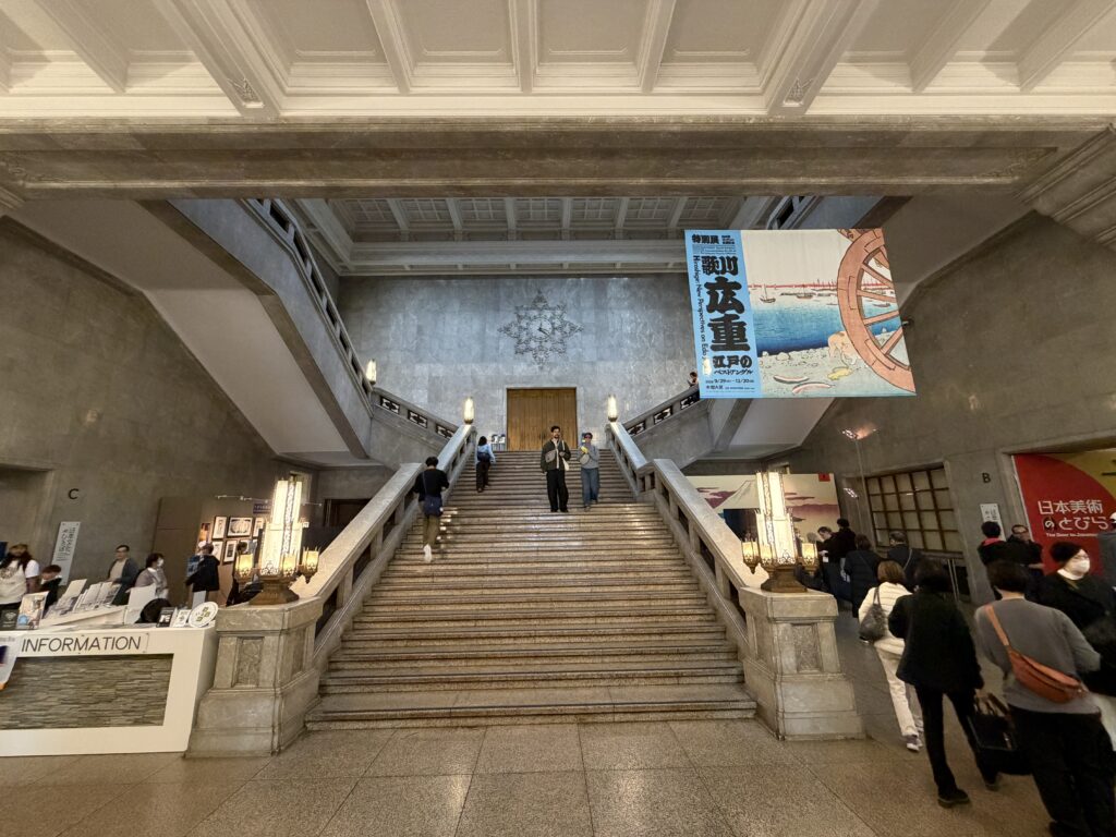
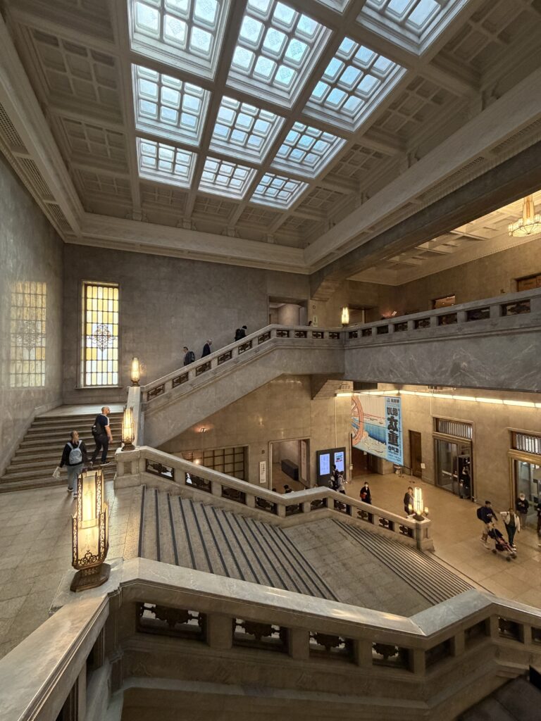
    Inside the entrance hall, a grand staircase rises under a coffered ceiling. You may recognize it: it often appears in Japanese TV dramas. The main building is huge, on two floors, and seeing the whole collection properly takes several hours. Visitors from abroad especially love the tea bowls used in the tea ceremony, the samurai armor and the Japanese swords.
    Make your own ukiyo-e print

    My favorite corner is near the entrance of the main building: a hands-on ukiyo-e corner, at no extra charge. You press five color stamps, one after another, onto the same card, lining each one up with a guide mark. Color by color, a woodblock-style picture appears, and you take home your own ukiyo-e postcard. Real ukiyo-e used many more blocks, and the panels explain how the professionals did it. It makes a lovely souvenir.
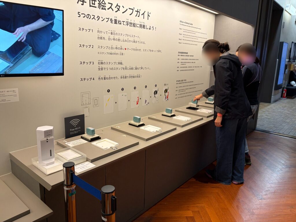
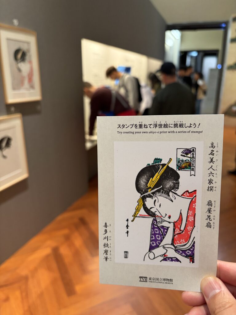
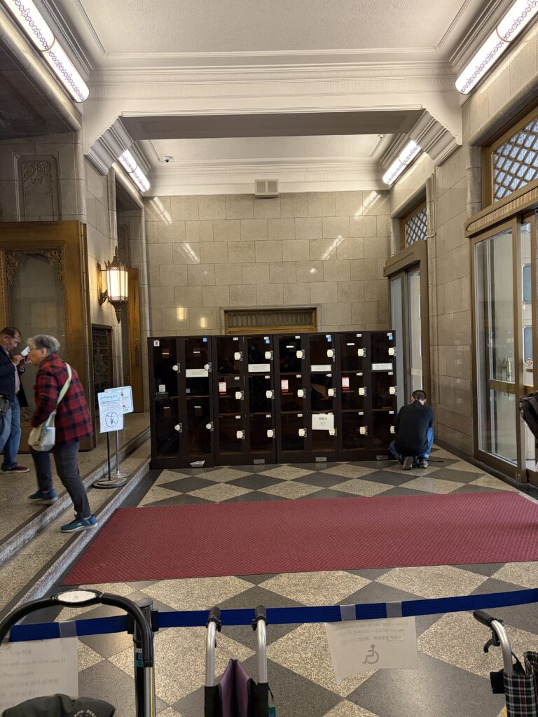
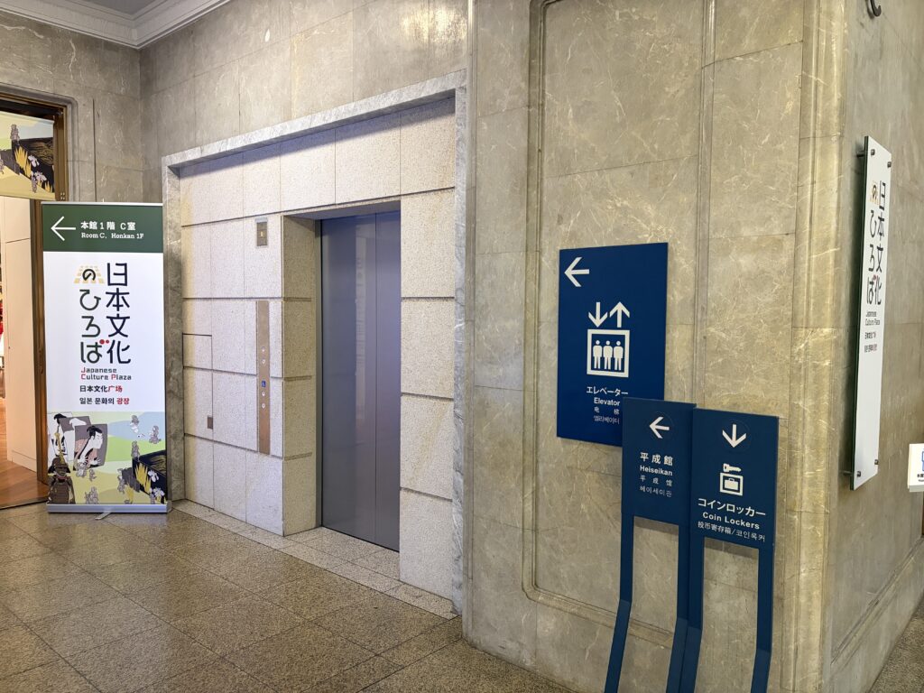
    When I visited, a special Hiroshige exhibition was on, and the museum was busy. There are plenty of sofas to rest on, coin lockers, and elevators as well as stairs.
    Two more buildings for two imperial weddings

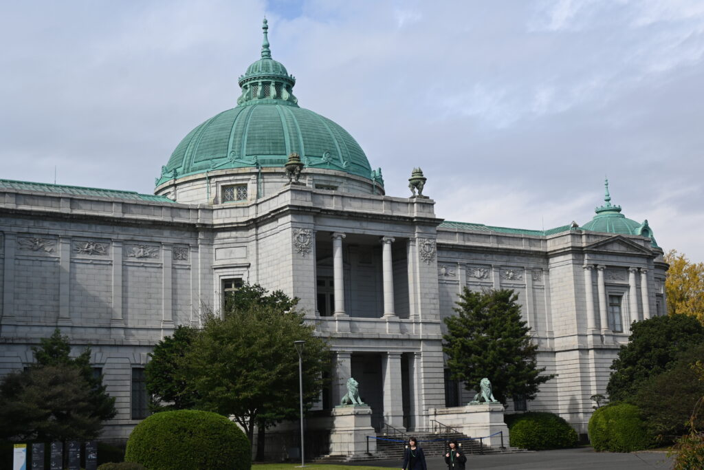
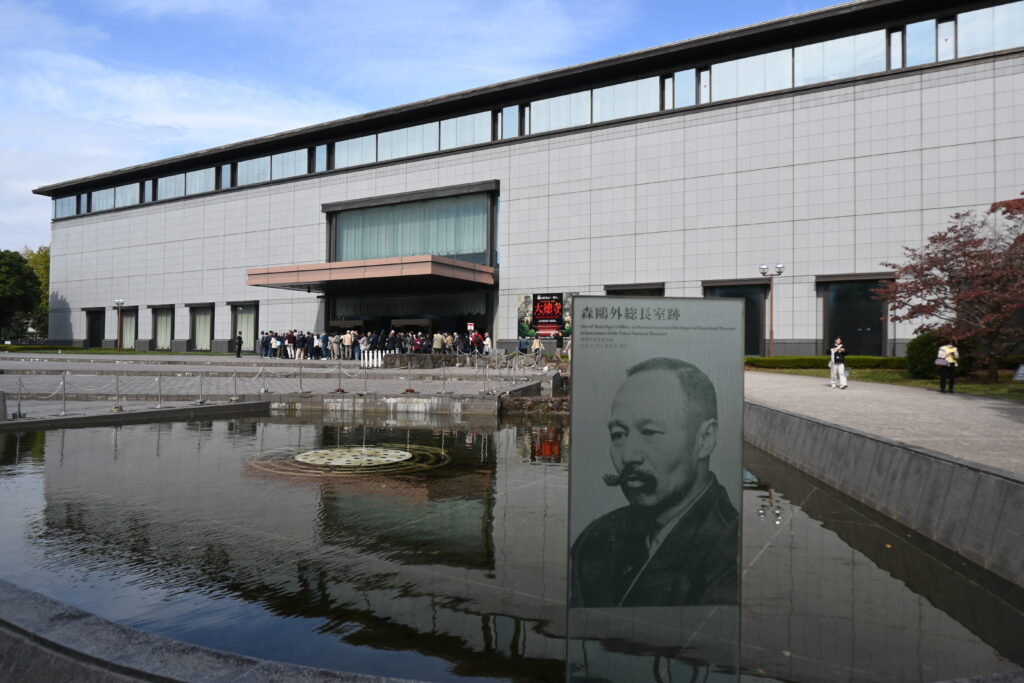
    To the left of the main building is the Hyokeikan, a domed palace in the Western style completed in 1908 to celebrate the wedding of the Crown Prince, later Emperor Taisho. It was designed by Katayama Tokuma, a student of Josiah Conder, and it is an Important Cultural Property. It was closed on my visit. Behind it, the modern Heiseikan opened in 1999 to mark the wedding of the then Crown Prince, today’s Emperor. It shows archaeology, including clay haniwa figures and Jomon dogu, and hosts the big special exhibitions.
    A ghost station and Japan’s oldest concert hall

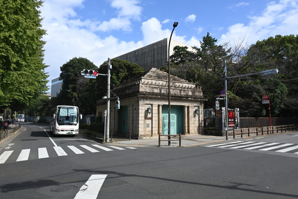
    Leave the museum and walk west along the road beside it. Opposite the Kuroda Memorial Hall stands a small stone building: the old Hakubutsukan-Dobutsuen Station, “Museum and Zoo Station”, on the Keisei Line. It opened in 1933. The land belonged to the Imperial family, so building a station here needed the approval of the Emperor himself, and the railway was told the building must be dignified enough for the site. That is why a small station looks like a little temple of classical architecture. Trains stopped calling in 1997, and the station was closed for good in 2004. It is opened to the public only for special events, so check the Keisei website.
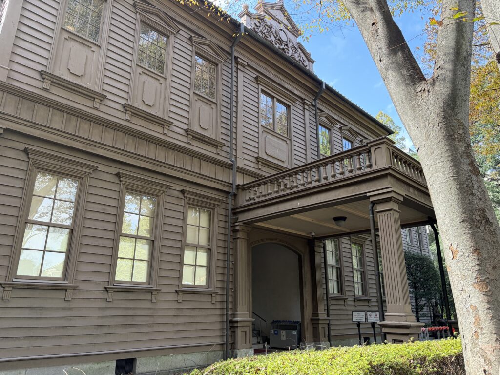
    Across the road stands the Sogakudo, built in 1890 for the Tokyo Music School, the forerunner of today’s Tokyo University of the Arts. It is the oldest Western-style concert hall in Japan and an Important Cultural Property. It is open to visitors on certain days, and there are often concerts.
    My favorite coffee break

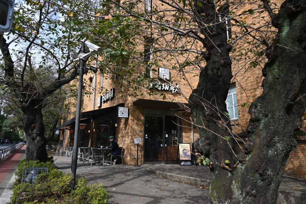
    On the corner opposite the old station is Ueshima Coffee House, at the Kuroda Memorial Hall. It is one of my favorite cafés in Ueno: it is usually less crowded than the cafés in the middle of the park, and from the window you can sit and look out at the old station and the Sogakudo. The perfect place to rest your legs before the last stretch.
    Kan’ei-ji today: a temple hall from Kawagoe

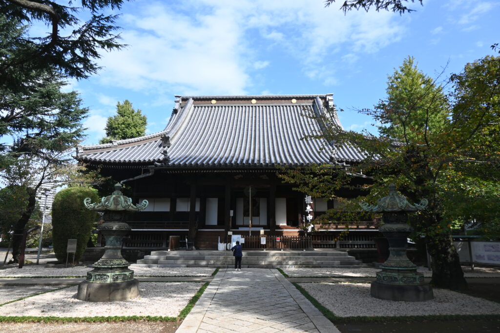
    Walk north along the road to find what remains of Kan’ei-ji. After the battle, the temple had lost almost everything, including its great main hall on today’s fountain square. In 1879 the monks brought a hall from Kitain, a temple in Kawagoe with deep ties to Kan’ei-ji’s founder Tenkai. It had been built there in 1638. The hall was taken apart, carried to Tokyo by boat, and rebuilt here as the new main hall. So the shoguns’ great temple, which once covered the whole hill, now lives quietly in a corner at the north end of the park.
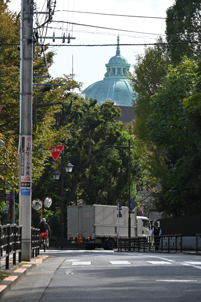
    From the road in front of the temple, look back: you can see the green dome of the Hyokeikan above the trees.
    Finish: Ryodaishi Bridge, on the ancient shore

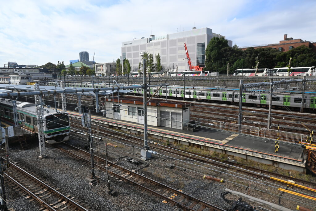
    End the walk at Ryodaishi Bridge, just north of Ueno Station, which crosses the railway from the hilltop. Its name comes from Ryodaishi, a temple of Kan’ei-ji nearby. From here you look down on a river of tracks: the Yamanote and Keihin-Tohoku Lines, the Utsunomiya, Takasaki and Joban Lines, and limited express trains such as the Hitachi. Because the trains are just leaving or entering Ueno Station, they move slowly, so you can watch them properly. Stay ten minutes and you will see many kinds of trains, sometimes three or four at once. Children love it, and so do I.
    Why the trains run along the foot of the hill

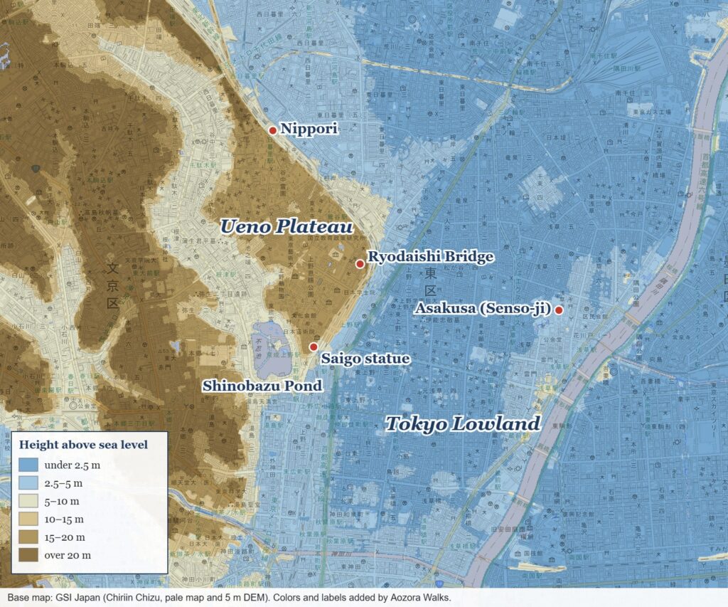
    Remember the elevation map in Part 1? The railway runs exactly along the foot of the Ueno Plateau, on the flat lowland. About 6,000 years ago, when the sea was higher than today, this lowland was the seashore.
    The proof lies a little farther north. At Kami-Nakazato in Kita City, at the foot of the same plateau, the Jomon people left the Nakazato shell mound, a heap of shells about 1 kilometer long and up to 4.5 meters deep, made about 4,600 to 3,900 years ago. It sits on what was then a sandy beach, and archaeologists think it was a kind of seafood factory, where people heated and dried shellfish to trade inland. Today the shell mound, now a National Historic Site, lies between two railway depots, the Tokyo Shinkansen depot and the Oku train depot. The Jomon beach has become a parking lot for trains.

    Trains and shell mounds have met before. In 1877 the American zoologist Edward Morse was riding the train from Yokohama to Shinbashi when he spotted layers of shells in a cliff near Omori. Because the railway runs along the foot of the plateau, the cliff was right beside his window. His dig at the Omori shell mound is remembered as the start of modern archaeology in Japan. So as you watch the trains from Ryodaishi Bridge, remember: you are standing on the edge of an ancient sea.

    Best time to go

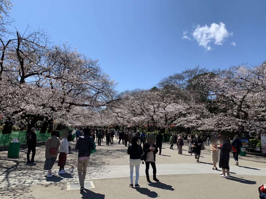
    Come on a weekday morning, Tuesday to Friday, when the museums open (9:30). The Tokyo National Museum and the National Museum of Western Art stay open until 20:00 on Fridays and Saturdays, which is a quieter time to visit. In late March and early April, the cherry blossoms make the walk beautiful, but very crowded.

    Good to know before you go

    • Mondays: the Tokyo National Museum and the National Museum of Western Art are closed (except on public holidays).
    • Tokyo Bunka Kaikan is closed for renovation until some time in fiscal 2028. You can only see the outside.
    • The National Museum of Western Art can be very crowded during special exhibitions. The Rodin sculptures outside are free.
    • Prices change: the permanent collection of the National Museum of Western Art will cost ¥1,000 for adults from 20 March 2027.
    • Give the Tokyo National Museum time. The main building alone can take several hours.
    • The old station is open only during special events, and the Sogakudo only on certain days. Check before you go.

    Getting there

    • Start: JR Ueno Station, Park Exit. From Asakusa, take the Ginza Line to Ueno (about 5 minutes) and walk through the station to the Park Exit.
    • From Narita Airport: Keisei Skyliner to Keisei Ueno, then walk up through the park (or start with Part 1).
    • Finish: from Ryodaishi Bridge, walk back to JR Ueno Station (about 5 minutes), or north to JR Uguisudani Station.

    Make a day of it

    See Ueno with a local guide

    This three-hour small-group tour in English covers Ueno Park, the Tokyo National Museum and the Ameyoko market. It is still new, with only a few reviews so far, though they are good. The museum ticket (¥1,000) is not included. Free cancellation up to 24 hours before. Prices may change, so check the details before you book.

    Where to stay

    Mitsui Garden Hotel Ueno

    Why choose: Right by JR Ueno and Keisei Ueno stations, so you can walk to the museums in minutes, and the Skyliner to Narita Airport is on your doorstep.

    Nohga Hotel Ueno Tokyo

    Why choose: A stylish small hotel that works with local craftspeople, in a quieter street east of Ueno Station. Good for design lovers.

    Official websites

    Next time

    Next time, we keep walking north from Kan’ei-ji into Yanaka and Nippori: quiet temple streets, the old-fashioned Yanaka Ginza shopping street, and the edge of the plateau where the Jomon people once lived beside the sea.

    Photos: Aozora Walks unless otherwise noted. Woodblock prints: National Diet Library Digital Collections (public domain): Kawanabe Kyosai, “Panorama of Ueno” (Famous Places of Tokyo, 1877), https://dl.ndl.go.jp/pid/1305644; Yoshu Chikanobu, “The Second National Industrial Exhibition at Ueno” (1881), https://dl.ndl.go.jp/pid/1307421. Elevation map made from GSI Japan’s Chiriin Chizu (pale map and 5 m DEM), with colors and labels added by Aozora Walks. Information as of October 2026.
  • Ueno Park History Walk, Part 1: Edo’s Sacred Hill, a Battlefield and a Racecourse

    Ueno Park History Walk, Part 1: Edo’s Sacred Hill, a Battlefield and a Racecourse

    This post contains affiliate links. If you book through them, I may earn a small commission at no extra cost to you.

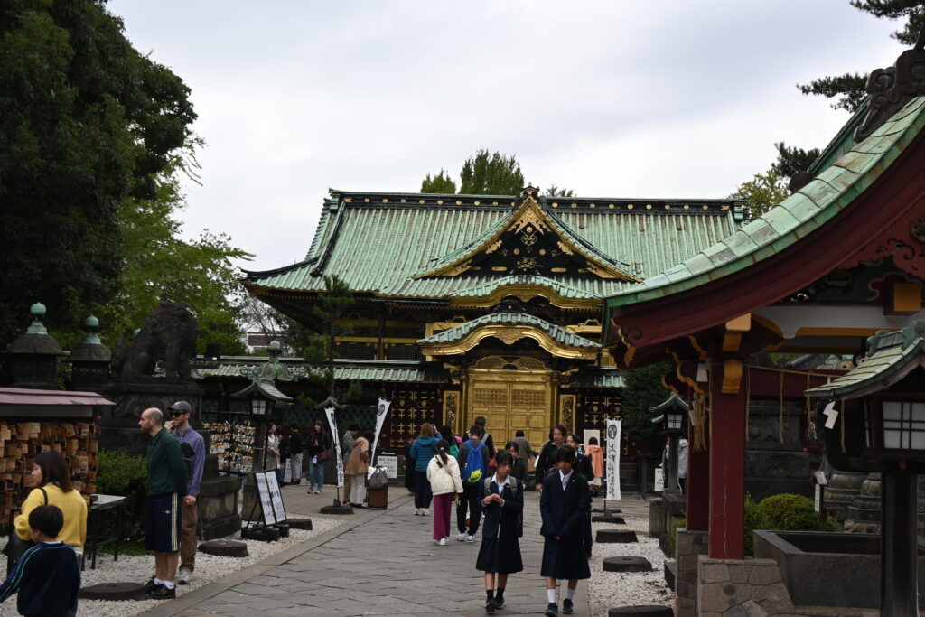
    Most visitors come to Ueno Park for its museums. But the park itself is the best museum in Tokyo, if you know how to read it. Over its long history, this hill has been the edge of an ancient sea, the holiest temple ground of the shoguns, a battlefield, and a racecourse where the Emperor watched horses gallop around a lotus pond.

    There is so much to see that I have split Ueno into two walks. This is Part 1, the south side of the park: the Edo-period temples, the Battle of Ueno and Shinobazu Pond. In Part 2 we will walk the north side, where the burned temple grounds became Japan’s museum quarter, with Le Corbusier’s only building in the country. As a geography teacher, I will also show you old woodblock prints from the 1850s, so you can compare them with the same places today.

    Quick facts

    RouteKeisei Ueno / JR Ueno (Shinobazu Exit) → Saigo statue and Shogitai grave → Kiyomizu Kannon-do → Bell of Time → Ueno Daibutsu → Ueno Toshogu → Shinobazu Pond and Benten-do → racecourse curve
    DistanceAbout 2 km, with some stairs and slopes
    Time1.5 to 2 hours
    CostThe park, temples and Benten-do are free. Ueno Toshogu charges a small fee to enter the inner precinct
    Best forHistory lovers, and anyone who wants Edo-period Tokyo without the crowds of Asakusa
    Nearest stationsKeisei Ueno (Keisei Line, Skyliner from Narita Airport) or JR Ueno, Shinobazu Exit

    Start at the edge of an ancient sea

    Walk out of Keisei Ueno Station or the Shinobazu Exit of JR Ueno and look up. In front of you, a steep green slope rises above the traffic. That slope is the edge of the Ueno Plateau, the eastern tip of the Musashino Plateau that covers much of western Tokyo. Everything around the station, and everything east toward Asakusa, is the flat Tokyo Lowland.

    The difference is not just a few stairs. After the last Ice Age ended, the sea rose quickly. At its peak, around 7,000 to 6,000 years ago, the sea level was 2 to 3 meters higher than today. Geologists call this the Jomon transgression, after the Jomon people who lived here then. The sea pushed deep inland and formed a long bay, and the Ueno Plateau stood above the water like a headland. The low ground where the trains now run was the seashore, and the valley on the west side, where Shinobazu Pond lies, was also filled with water.

    How do we know? The Jomon people left their shells. Just north of here, below the temple of Enmei-in near Nippori Station, workers digging soil in 1888 found a shell mound, a Jomon rubbish heap of shells. It faced the valley on the west side of the plateau. In Part 2 we will meet an even bigger one on the east side. Ueno Park itself also hides traces of the ancient past: Suribachiyama, the small round hill near the Tokyo Bunka Kaikan, is believed to be an ancient burial mound.

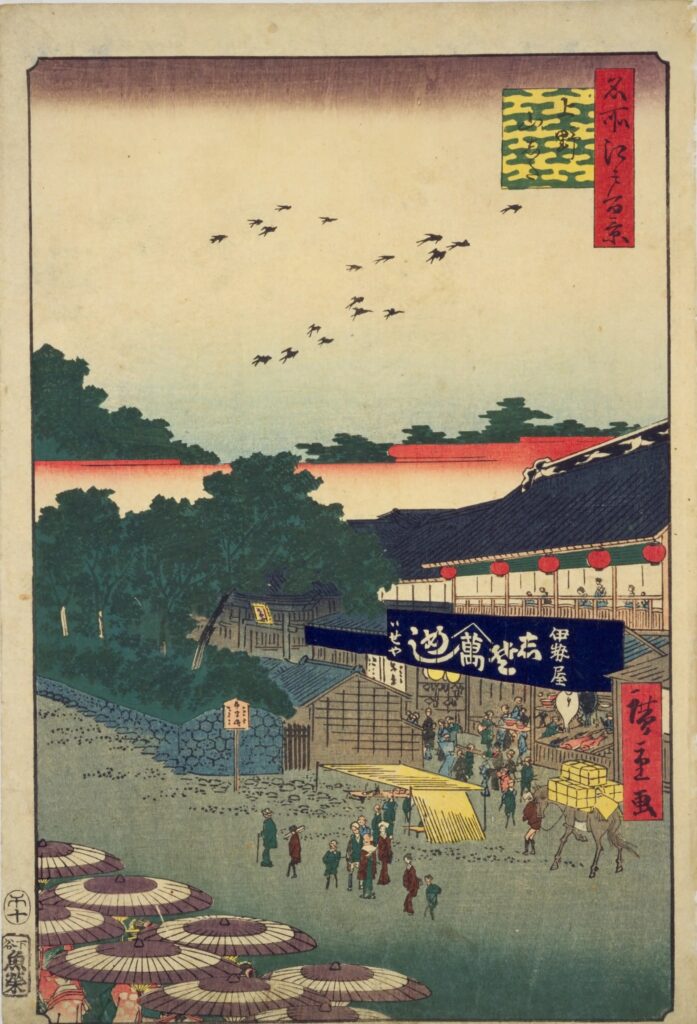
    By the Edo period the sea had long gone, and the foot of the hill had become one of the busiest shopping streets in the city. Hiroshige drew it in 1858: the dark green hill on the left, a big shop on the right, and crowds of people with umbrellas in between.

    The same idea is still true. Ueno grew up at the place where the hill meets the lowland, and where travelers arrived from the north. Today the trains do the same job.

    A temple city guarding Edo

    In 1625, the monk Tenkai founded Kan’ei-ji on this hill for the Tokugawa shoguns. It was built in the northeast of Edo Castle, the direction from which bad luck was believed to come, to protect the city. The whole hill was its temple ground, with dozens of halls, and six shoguns were later buried here.

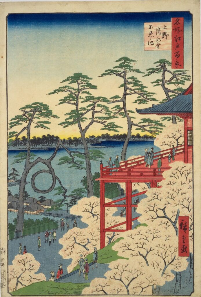
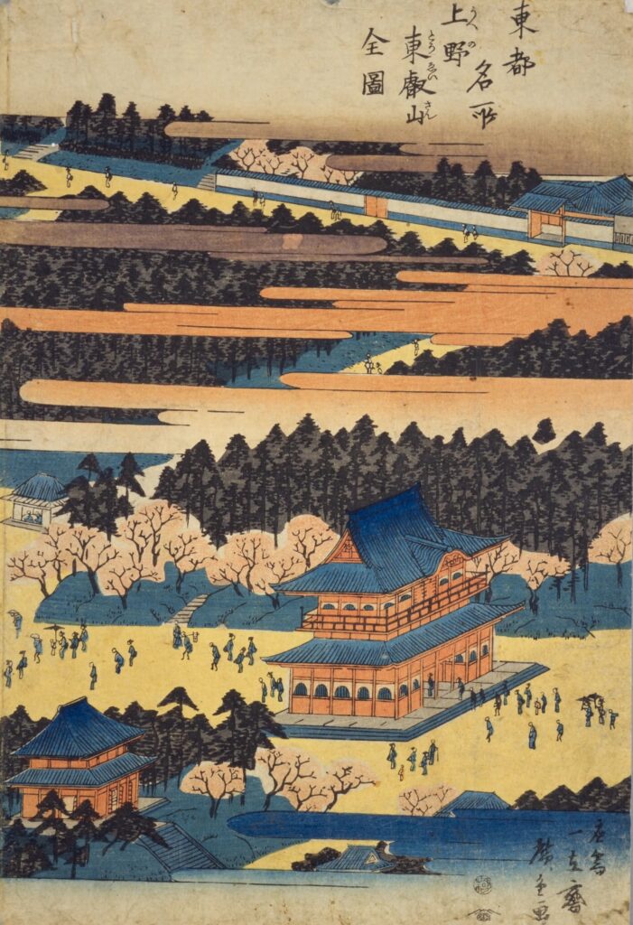
    Tenkai wanted Edo to have everything Kyoto had. Kyoto has Mount Hiei, the great temple mountain in the northeast of the city, so he named this hill Toeizan, “the Hiei of the East”. Shinobazu Pond became a small Lake Biwa, and a copy of Kyoto’s Kiyomizu-dera was built on the slope. Hiroshige’s bird’s-eye view shows how grand it was: halls and pagodas floating among the pines and clouds.

    What stayed the same: every spring, crowds still come to walk under the cherry trees, just like the people Hiroshige drew in front of the great hall. What changed: the hall itself burned in 1868. Its site is now the fountain square, which we will visit in Part 2.

    How did it all burn down in a single day? Let’s climb the stairs to the first stop.

    Saigo Takamori and the Battle of Ueno

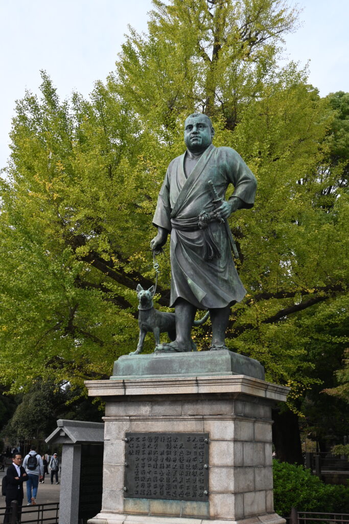
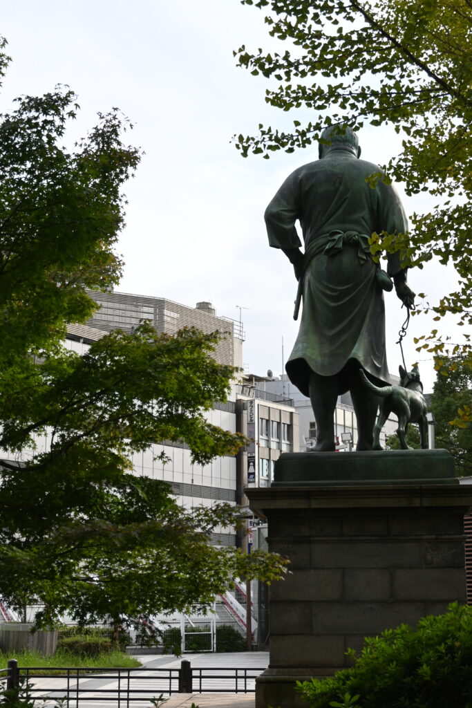
    At the top of the stairs stands Tokyo’s most famous statue: Saigo Takamori in a simple kimono, with his dog at his side. Saigo was one of the leaders of the new Meiji government’s army that ended the rule of the shoguns.

    In 1868, the last shogun had already surrendered Edo Castle without a fight. But a group of his loyal samurai, the Shogitai, refused to give up. They barricaded themselves on this hill inside Kan’ei-ji. On 4 July 1868, the government army attacked. The battle lasted only one day. The Shogitai were defeated, and fire destroyed most of the great temple.

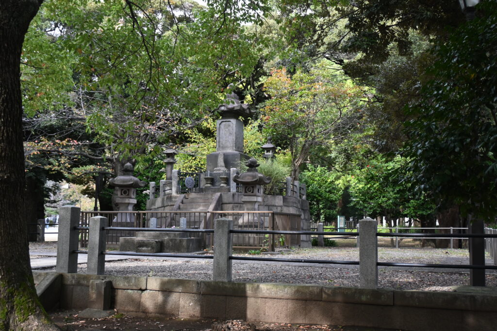
    Now walk around to the back of the statue. Hidden among the trees, just behind Saigo, are the graves of the Shogitai, the men his army defeated. The winner looks out over the city, and the losers rest behind his back. I find this one of the most moving corners of Tokyo.

    “My husband was not like this!”

    The statue was made by the sculptor Takamura Koun and unveiled in 1898. There is a famous problem with it: no photograph of Saigo is known to exist, so the sculptor worked from portraits drawn after his death. At the unveiling ceremony, Saigo’s widow, Ito, is said to have blurted out, “My husband was not a man like this!” People still argue about what she meant. Some say the face did not look like him. Others say she was upset that he was shown in casual clothes in public. This scene opens the first episode of the 2018 NHK drama Segodon, about Saigo’s life.

    Remember this story. In Part 2, we will meet another statue in Ueno Park with an even stranger face problem.

    Kiyomizu Kannon-do: Kyoto’s stage on a Tokyo hill

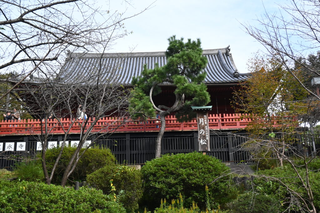
    A few steps away is Kiyomizu Kannon-do, built in 1631 as a copy of Kyoto’s Kiyomizu-dera. Like the original, it stands on a wooden stage built out over the slope. It is one of the oldest buildings in the park, survived the Battle of Ueno, and is now an Important Cultural Property.

    Then and now: the Moon Pine

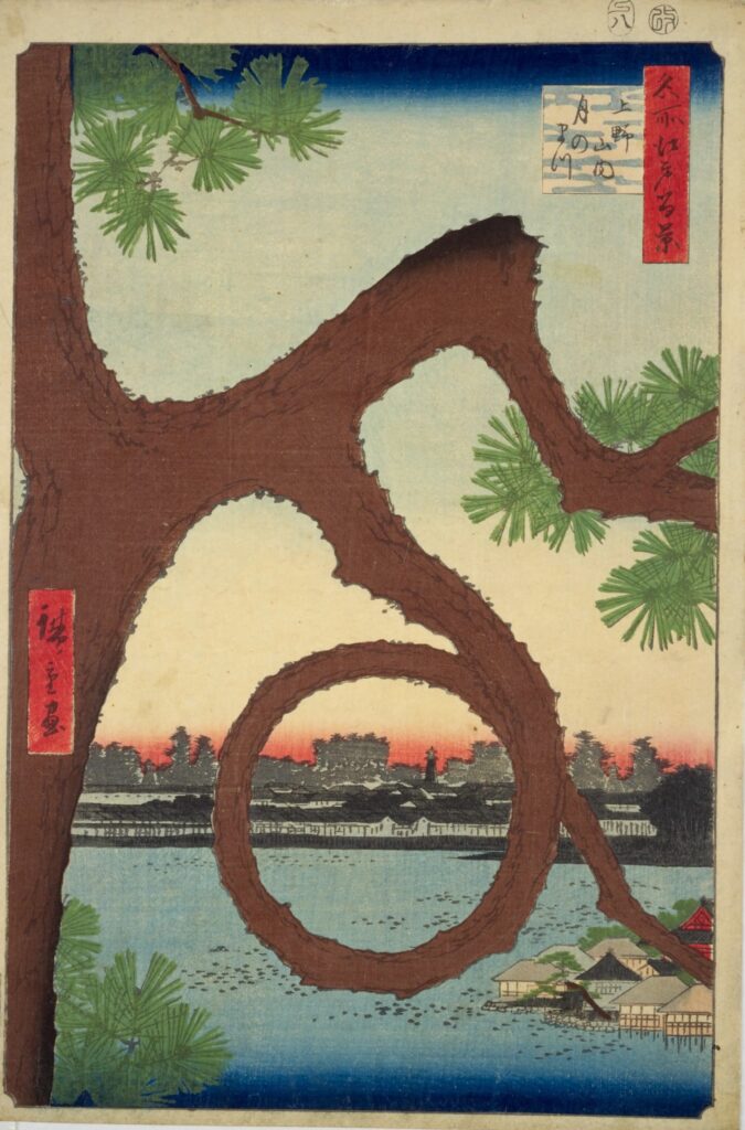
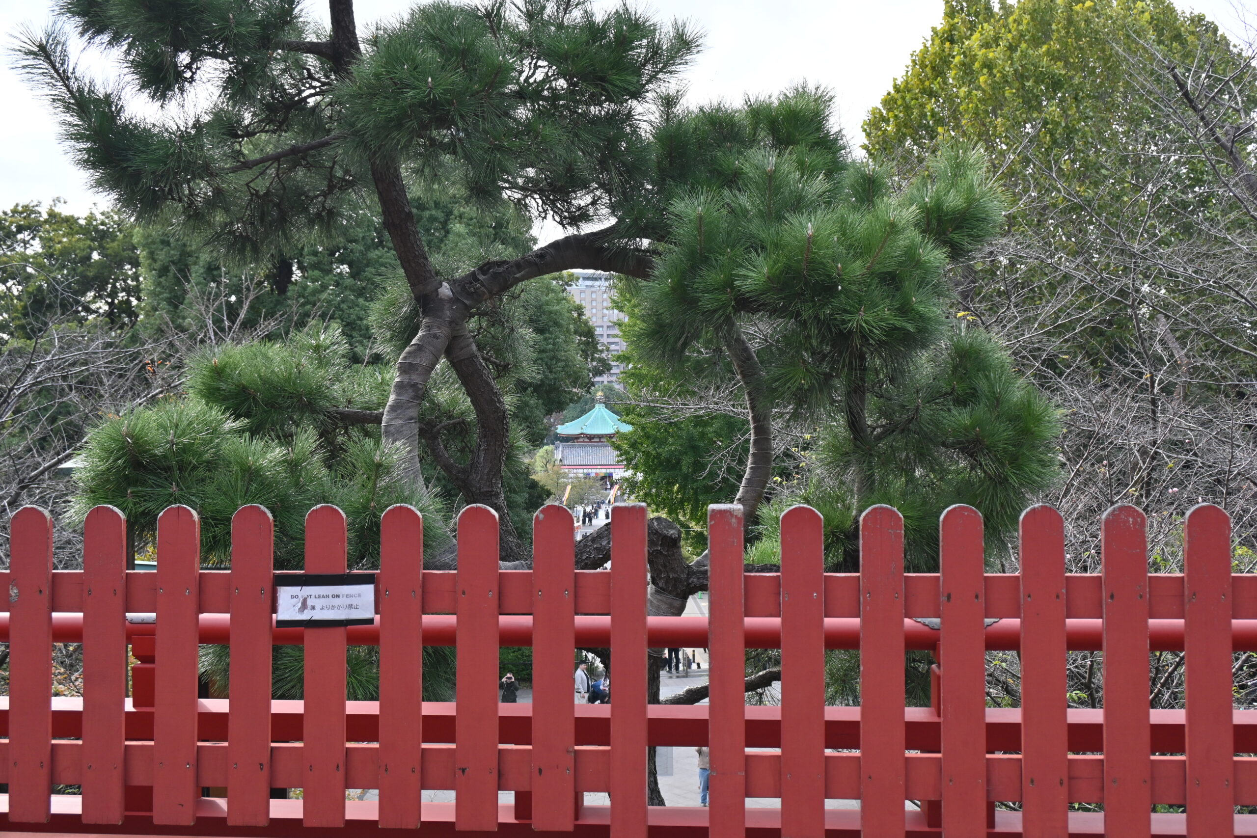
    Look at the left side of Hiroshige’s print. A pine tree has a branch that loops into a perfect circle. This is the Moon Pine (Tsuki no Matsu). Hiroshige liked it so much that he gave it a print of its own, with Shinobazu Pond and the temple island framed inside the ring.

    The original pine was lost in a typhoon in the early Meiji period. In 2012, about 150 years later, a new Moon Pine was trained into a ring and planted in front of the stage.

    What stayed the same: the stage, the temple and the idea of a pine framing the view. What changed: the trees around the pond have grown so tall that today you can hardly see the water through the ring. You can still spot the temple on the island, though.

    Shells from the battle

    Step inside the hall and look up to the right. A large painting of the Battle of Ueno hangs there, and fixed to the right side of its frame are two shells said to have been fired during the battle. The government army had modern Armstrong guns, and it is said that they fired across Shinobazu Pond from the Kaga domain’s estate on the opposite hill, where the University of Tokyo stands today. Quiet as it is now, this hall stood in the middle of the fighting.

    The Bell of Time

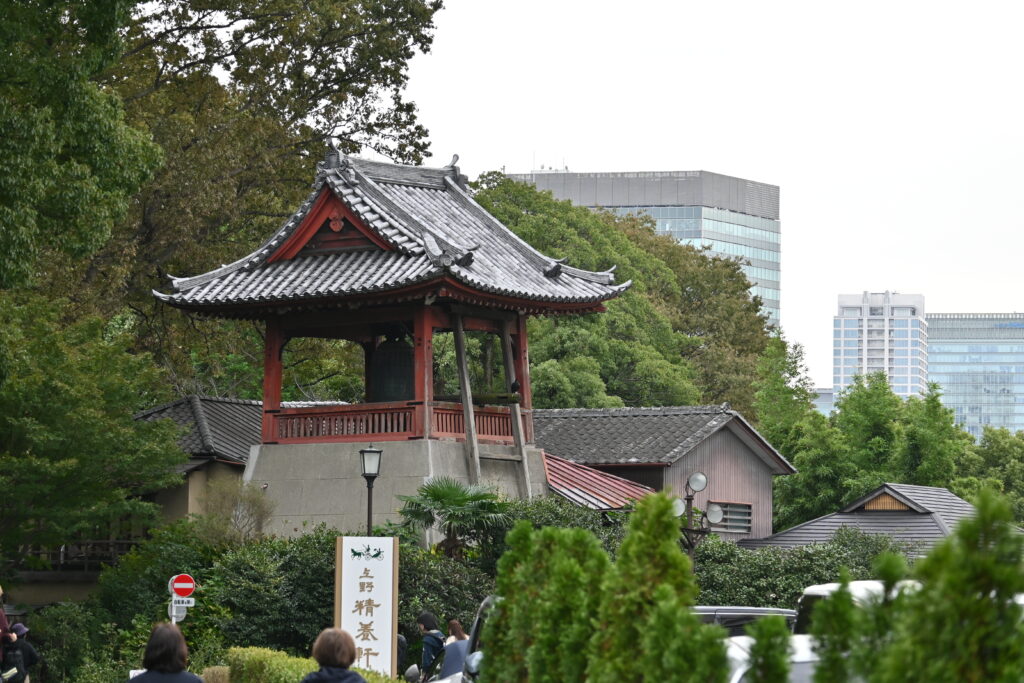
    Walk north along the path toward the Seiyoken restaurant. On a small mound stands the Bell of Time (Toki no Kane). In the Edo period, nine bells around the city rang out the hours, and this is the only one still in use. The bell itself was recast in 1787. It still rings three times a day, at 6:00, noon and 18:00, so time your walk to hear it.

    How did the Edo people tell time? They divided daytime, from sunrise to sunset, into six equal “hours”, and night into six more. So a daytime hour was longer in summer and shorter in winter. Before the bell rang the hour, it rang three warning strokes, so people knew to start counting.

    The Great Buddha who cannot fall any further

    Just behind the bell is one of the strangest sights in Tokyo: a giant Buddha’s face, set into a wall, with no body. The Ueno Daibutsu was first made in 1631 and recast in 1843. In the Great Kanto Earthquake of 1923 its head fell off. The body was kept by the temple, but in 1940 it was taken away to be melted down for metal during the war. Only the face survived. Since 1972 it has been displayed here, next to a small pagoda.

    Because it has already lost everything and “cannot fall any further”, Japanese students now come here to pray to pass their entrance exams. (In Japanese, failing an exam is “falling”.) You will see many wooden prayer plaques with students’ wishes.

    Ueno Toshogu: a shrine that escaped the fires

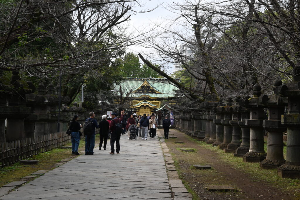
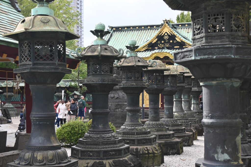
    Continue along the stone lantern path to Ueno Toshogu, a shrine to Tokugawa Ieyasu, the first shogun. It was founded in 1627, and the present gold-covered hall dates from 1651. It survived the Battle of Ueno, the 1923 earthquake and the air raids of 1945, which makes it one of the few early Edo buildings left in Tokyo. The hall, its gate and the bronze lanterns are Important Cultural Properties.

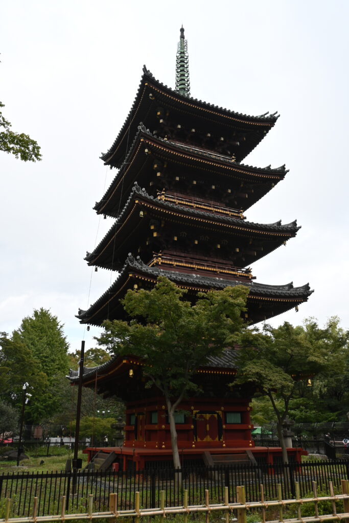
    Near the shrine you can see the top of a five-story pagoda. It belonged to the shrine, but after the Meiji government ordered Shinto and Buddhism to be separated in 1868, Buddhist buildings at shrines were in danger of being pulled down. The priest saved the pagoda by declaring that it belonged to Kan’ei-ji, the temple. Today it stands inside Ueno Zoo.

    Shinobazu Pond: a temple island and a racecourse

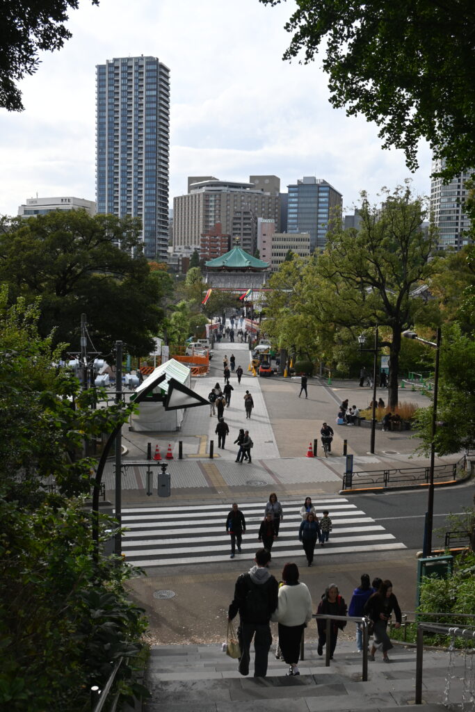
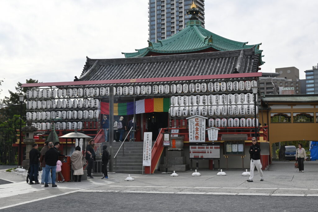
    Walk down the slope to Shinobazu Pond. A causeway leads to Benten-do, an eight-sided temple to Benzaiten, the goddess of water, music and wealth, on an island in the pond. This is the island you saw through Hiroshige’s Moon Pine.

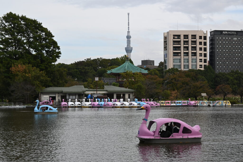
    On the west side of the island you can rent rowing boats, cycle boats and swan boats, popular with families and couples. From the water you get a fine view back to the temple, with Tokyo Skytree in the distance.

    Then and now: horses around the pond

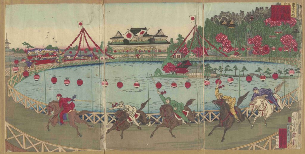
    Here is my favorite secret of Ueno. From 1884 to 1892, there was a horse racecourse around Shinobazu Pond. The first races, on 1 November 1884, were watched by Emperor Meiji himself. Horse racing was part of the government’s plan to make Japan look modern and Western, and woodblock artists rushed to print the scene.

    This print, made the year the racecourse opened, shows the jockeys galloping along the edge of the pond, with the hill of Ueno behind. Using prints like this, I found what I believe is one of the old corners of the track: the gentle curve of the path in front of the Shitamachi Museum, at the south end of the pond. The rest of the course continued into what is now Ueno Zoo, so you cannot walk the full lap.

    What stayed the same: the pond, the island temple and the hill behind. What changed: the horses and the crowds have gone, and the track is now a quiet path for joggers and strollers.

    If you have time, the small Shitamachi Museum beside the curve recreates the streets and homes of old downtown Tokyo, and you can step inside the houses (¥300, closed on Mondays).

    Best time to go

    Morning is best, when the temples are quiet. Plan to reach the Bell of Time at noon to hear it ring. Late March to early April is cherry blossom season and Ueno Park becomes one of the most crowded places in Tokyo, which is beautiful but slow. In July and August, Shinobazu Pond is covered with huge lotus leaves and flowers, best early in the morning.

    Good to know before you go

    • Stairs and slopes. There are stairs from the station up to the Saigo statue, and from Kiyomizu Kannon-do down to the pond. With a wheelchair or stroller, use the gentle slope from the Keisei Ueno side and the road around the pond.
    • The Shogitai grave is easy to miss. It is in the trees directly behind the Saigo statue.
    • The view through the Moon Pine is partly blocked by trees today. Look for the temple on the island.
    • Ueno Toshogu is free to visit from outside the fence. Entering the inner area around the gold hall costs a small fee.
    • Boats are rented by the half hour. The boat house closes on Wednesdays from December to February.
    • Respect the temples. Kiyomizu Kannon-do and Benten-do are places of prayer. Keep your voice low inside the halls.

    Getting there

    • From Narita Airport: the Keisei Skyliner runs straight to Keisei Ueno Station, the start of this walk, in under an hour.
    • From Asakusa: Tokyo Metro Ginza Line to Ueno, about 5 minutes. Take the exit for JR Ueno Station’s Shinobazu side.
    • Going on: Ameyoko market is right across the road from the start, and Part 2 of this walk begins at the Park Exit of JR Ueno Station.

    Make a day of it

    Walk Ueno with a local guide

    If you would like a guide, this three-hour small-group tour in English starts at the Shinobazu Exit of JR Ueno Station and covers Kiyomizu Kannon-do, Shinobazu Pond and Benten-do, the Tokyo National Museum and the Ameyoko market. It is still quite new, with only a few reviews so far, though they are good. The museum ticket (¥1,000) is not included. Free cancellation up to 24 hours before. Prices may change, so check the details before you book.

    Where to stay

    Ueno is a smart base: the Skyliner from Narita arrives here, the Ginza Line takes you to Asakusa in 5 minutes, and the JR Yamanote Line goes around the whole city.

    Mitsui Garden Hotel Ueno

    Why choose: A comfortable, reliable hotel a short walk from JR Ueno and Keisei Ueno stations. Very convenient if you arrive from Narita Airport with luggage.

    Nohga Hotel Ueno Tokyo

    Why choose: A stylish small hotel that works with local craftspeople, in a quieter street east of Ueno Station. A good choice if you like design and want a local neighborhood feel.

    Official websites

    Next time

    Next time, in Part 2, we climb back up the hill to the north side of Ueno Park. After the battle, the burned temple grounds were almost turned into a hospital, until a Dutch doctor stepped in. We will see what grew there instead: the Tokyo National Museum, Le Corbusier’s National Museum of Western Art, a ghost station, and a bridge where children can watch a dozen kinds of trains pass beneath their feet.

    Photos: Aozora Walks unless otherwise noted. Woodblock prints: National Diet Library Digital Collections (public domain): Hiroshige, “Foot of Ueno Hill”, https://dl.ndl.go.jp/pid/1312248; Hiroshige, “Complete View of Toeizan Temple at Ueno”, https://dl.ndl.go.jp/pid/1302538; Hiroshige, “Kiyomizu Hall and Shinobazu Pond at Ueno”, https://dl.ndl.go.jp/pid/1312247; Hiroshige, “The Moon Pine, Ueno”, https://dl.ndl.go.jp/pid/1312325. Utagawa Kunitoshi, “Opening of the Shinobazu Pond Racecourse” (1884): collection of the Tokyo Metropolitan Central Library (public domain), TOKYO Archive, call number 5892-C5. Elevation map made from GSI Japan’s Chiriin Chizu (pale map and 5 m DEM), with colors and labels added by Aozora Walks. Information as of October 2026.
  • Nihonbashi Walk: Where Japan’s Roads Begin, Under an Expressway About to Vanish

    Nihonbashi Walk: Where Japan’s Roads Begin, Under an Expressway About to Vanish

    This post contains affiliate links. If you book through them, I may earn a small commission at no extra cost to you.

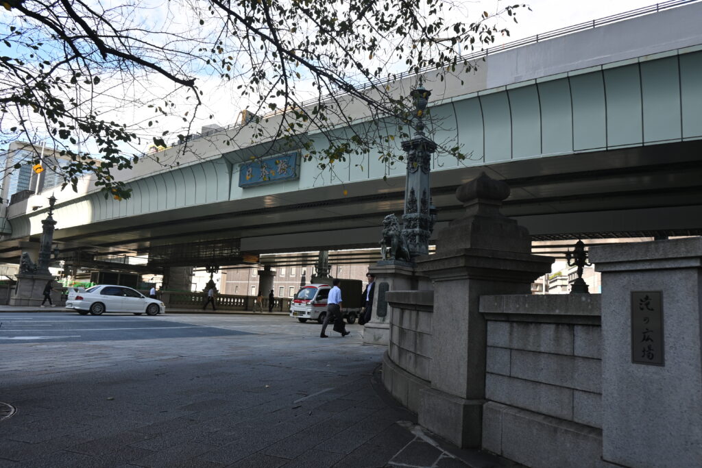
    Stand in the middle of Nihonbashi and look up. Instead of sky, you see the underside of an expressway. Look down, and there is a small bronze plate in the road: the point from which distances across Japan are still measured. This bridge was the starting point of the old highways of Edo, and today it is one of the best places in Tokyo to see how the city keeps rebuilding itself.

    In the last post, we rode the Yurikamome back from Odaiba to Shimbashi. From there, the Ginza Line takes you to Nihonbashi in a few minutes. As a geography teacher, I think this short walk explains more about Tokyo than almost anywhere else: the roads, the river, the fish market, the first department store, the central bank and the gates of Edo Castle, all within about one kilometer.

    Quick facts

    RouteNihonbashi Station → Nihonbashi bridge → fish market memorial → Mitsukoshi → COREDO Muromachi → Bank of Japan → the three Tokiwa bridges
    DistanceAbout 1.5 km on flat ground
    Time2 to 3 hours with stops (1 hour if you only walk)
    CostFree to walk. River cruises from ¥2,500 (optional)
    Nearest stationsNihonbashi or Mitsukoshimae (Tokyo Metro Ginza Line)

    Start: Nihonbashi Station

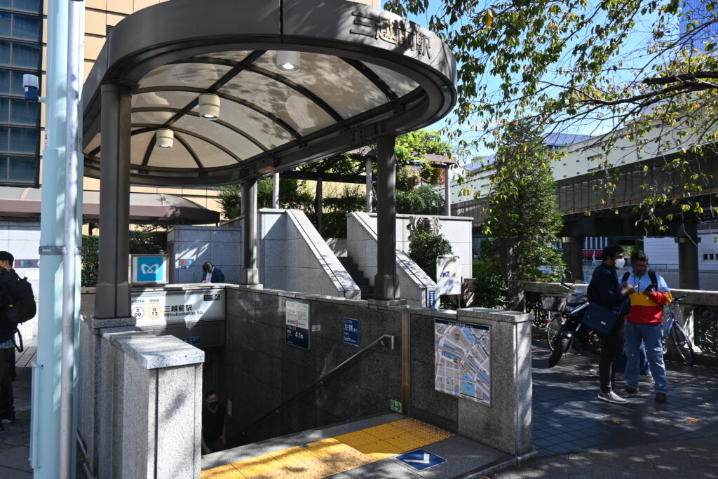
    From Nihonbashi Station on the Ginza Line, take Exit B10. You come up on Chuo-dori, the main street. Walk to the next big intersection and turn right, and the bridge appears under the expressway.

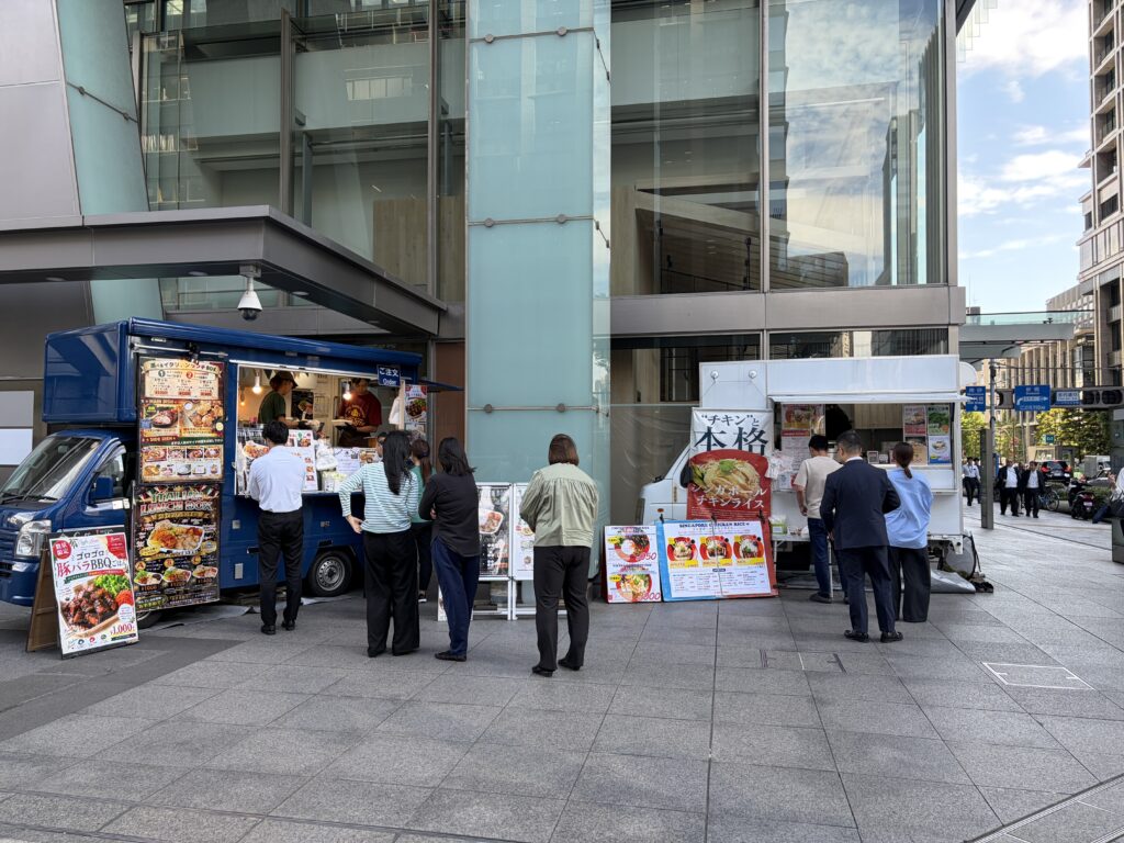
    Right outside Exit B10, on the south-east corner of the Nihonbashi intersection, food trucks park at lunchtime, selling bento boxes to office workers. A handy stop if you want to eat before you start walking.

    The bridge where all roads began

    The first Nihonbashi, a wooden bridge, was built in 1603, the year Tokugawa Ieyasu became shogun. Soon after, the shogunate made it the starting point of the five main highways of Japan, including the Tokaido to Kyoto. Travelers, goods and news all passed over it. The name simply means “Japan Bridge”.

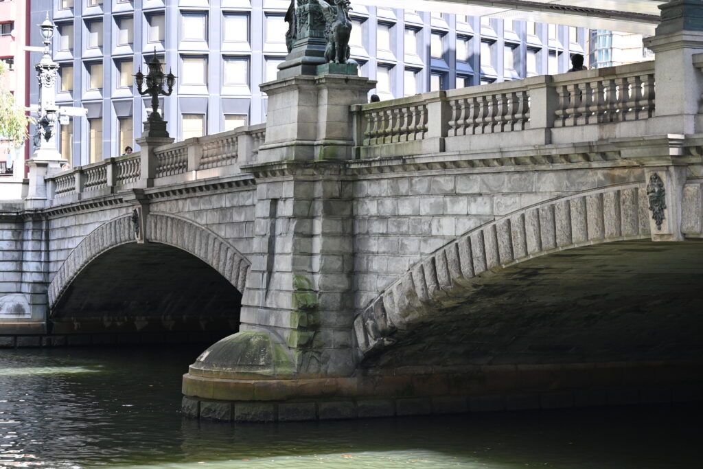
    The wooden bridge burned and was rebuilt many times. The stone bridge you see today was completed in 1911. It is the 20th Nihonbashi, and it became a national Important Cultural Property in 1999.

    Lions, kirin and the last shogun

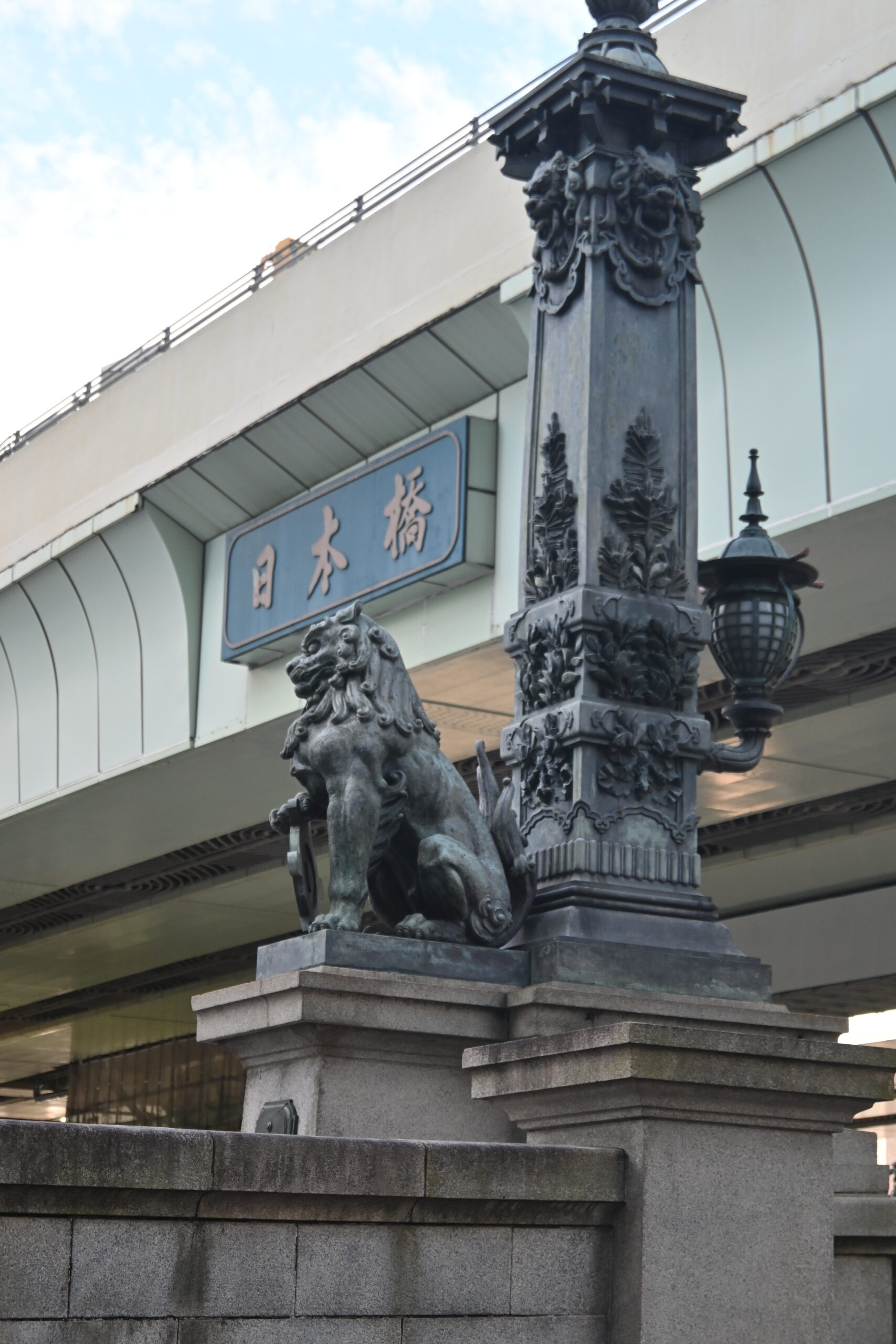
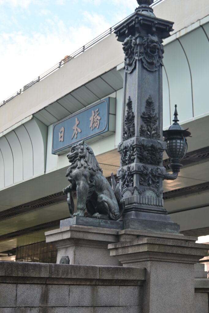
    The bronze decorations on the bridge are wonderful, so take your time. The lions hold the crest of the city of Tokyo. The creatures with wings are kirin, mythical animals. They are often said to have wings so that they can fly from the starting point of Japan’s roads to every corner of the country.

    Look at the name plates on the bridge posts. The characters “日本橋” were written by Tokugawa Yoshinobu, the last shogun. The same characters appear on the side of the expressway above, copied from the plates. Even the expressway pays its respects to the bridge.

    Scars from 1945

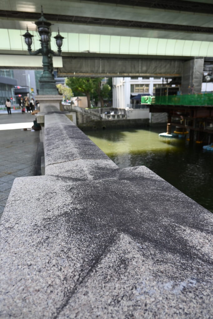
    Now look closely at the stone railings. The dark stains are burn marks, and a sign on the bridge explains that they were left by the Great Tokyo Air Raid of 1945. Incendiary bombs fell on the bridge and burned on the stone. Nobody painted over them.

    On the night of 10 March 1945, American bombers dropped incendiary bombs over the wooden neighborhoods of eastern Tokyo. The fires killed an estimated 100,000 people in a single night. Nihonbashi burned, and so did Asakusa: the main hall of Senso-ji was lost that night. If you followed this series from Part 2, you have already seen the ginkgo tree beside Senso-ji that still carries its burn scars. The stone bridge survived. The black marks are its scars, and a small piece of war history you can touch.

    Kilometer zero

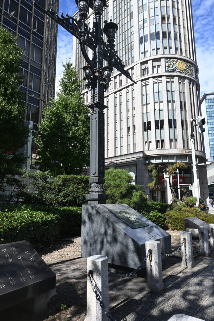
    In the middle of the road, between the two lanes, is the Japan Road Origin Marker. Distances on many national roads are still measured from here. You cannot walk into the traffic to see it, but there is a full-size replica at the north end of the bridge, beside the kirin.

    Then and now: Hiroshige’s Nihonbashi

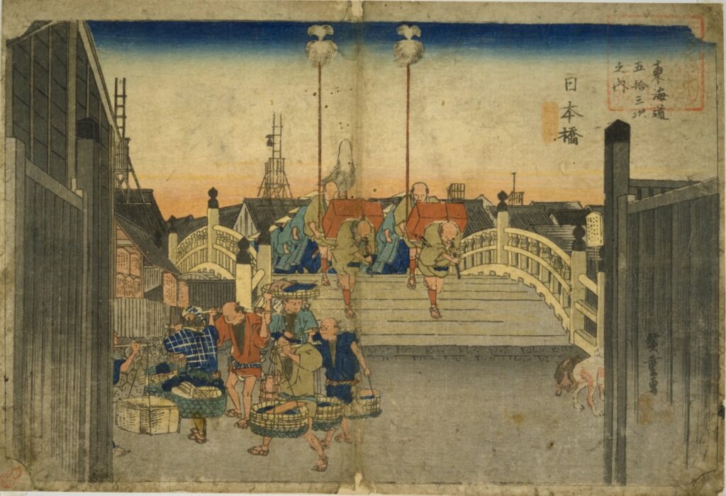
    The most famous picture of this bridge is the very first print in Utagawa Hiroshige’s series The Fifty-three Stations of the Tokaido, published in the 1830s. A daimyo procession is setting out across the arched wooden bridge at dawn, at the start of the long road to Kyoto.

    What stayed the same: the place and its role. The bridge still crosses the same river at the same spot, and it is still where Japan’s roads begin. Look at the bottom left of the print, too: men carrying baskets of fish. They are coming from the fish market at the foot of the bridge, which we will visit in a moment.

    What changed: almost everything you can see. The high wooden arch became twin stone arches, built low and flat for trams and cars. The wide sky in the print is now covered by the expressway, built in 1963 in a rush before the 1964 Tokyo Olympics, along the river because there was no land left to build on.

    And it will change again. The expressway above Nihonbashi is being moved underground. The tunnel is planned to open around 2035, and the elevated road is scheduled to be removed by around 2040. When it is gone, the bridge will see the sky again for the first time in more than 70 years. If you come now, you are seeing a view that will soon be history.

    Want to walk across the old wooden bridge from Hiroshige’s print? At the Edo-Tokyo Museum in Ryogoku, the northern half of the wooden Nihonbashi has been rebuilt at full size at the entrance to the permanent exhibition. The museum reopened in March 2026 after a major renovation, and it is the best place to learn more about the history of Edo and Tokyo.

    From the river: Nihonbashi Cruise

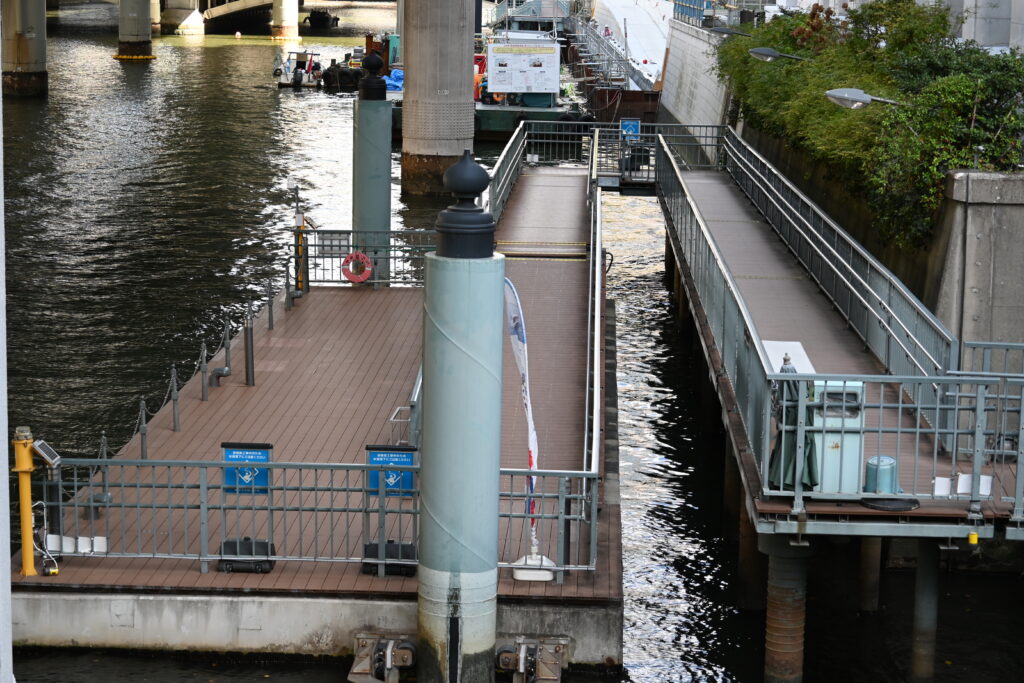
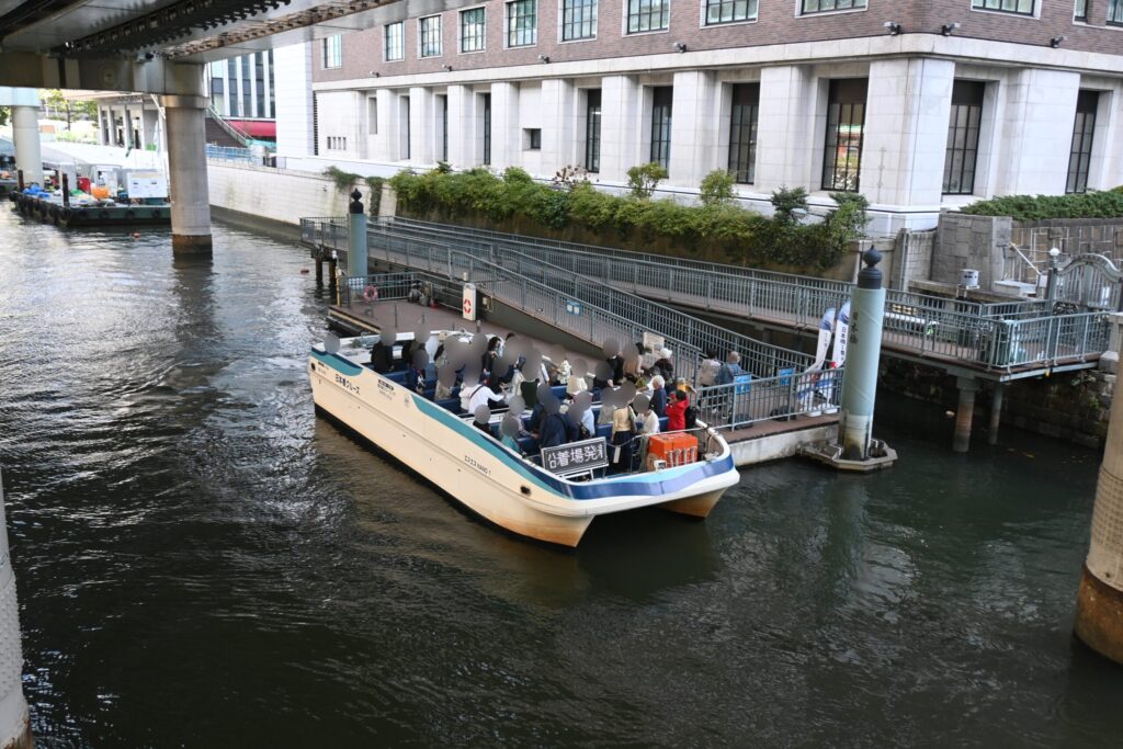
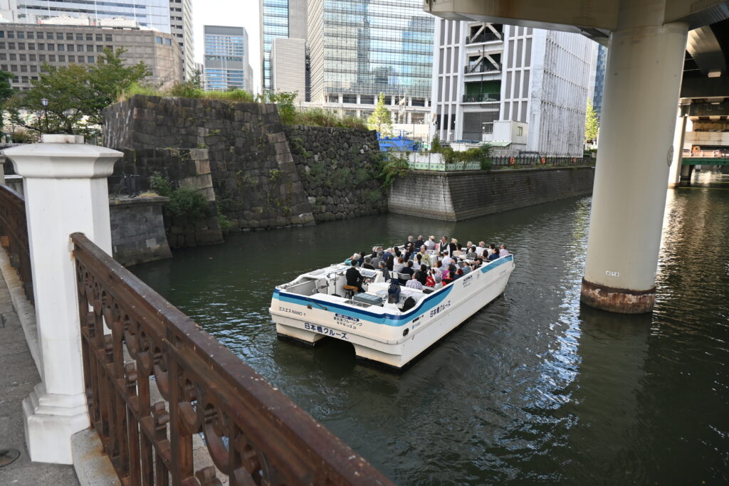
    Walk down to the river pier at the north end of the bridge. From under the bridge you can see the stone arches and the expressway pillars standing in the water.

    Small open boats run by Nihonbashi Cruise leave from here. The regular course goes around the old moats of Edo Castle along the Nihonbashi and Kanda rivers in about 90 minutes, from ¥2,500 for adults (as of October 2026). I didn’t ride it this time, but I watched the boats come and go, with the guide talking all the way. Note that the commentary is in Japanese. Check the official website for courses, times and booking.

    Where the fish market began

    Back up on the street, cross to the north-east corner of the bridge. A small monument with a statue of the sea princess Otohime marks the site of Tokyo’s first fish market, the uogashi.

    The market began in the early 1600s, when fishermen from Tsukuda village near Osaka, invited to Edo by Ieyasu, started selling the fish left over after supplying the shogun’s castle. Boats brought fresh fish straight up the river to the stalls along the bank. For about 300 years, this was the kitchen of Edo.

    The Great Kanto Earthquake of 1923 destroyed it, and the market moved to Tsukiji, then in 2018 to Toyosu. To be honest, nothing of the market is left. There is only the monument. But if you remember the fish carriers in Hiroshige’s print, the empty riverbank tells its own story.

    Mitsukoshi: from kimono shop to department store

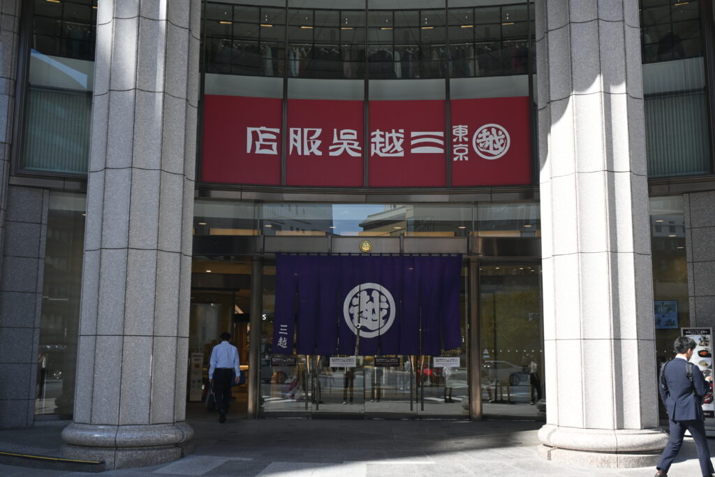
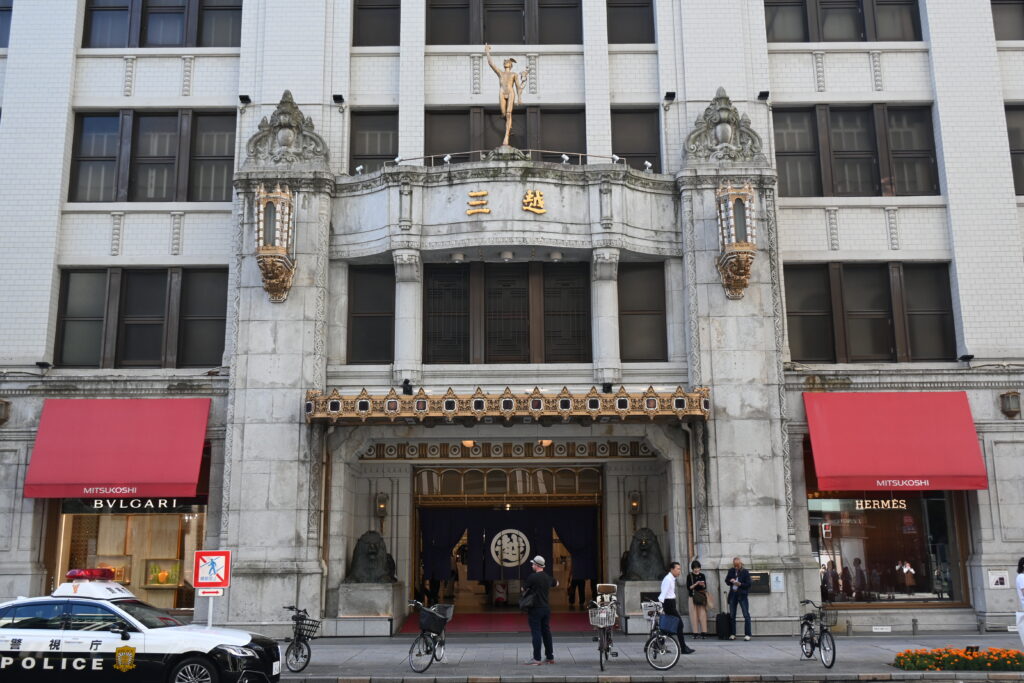
    Walk north on Chuo-dori to Mitsukoshi. Its roots go back to 1673, when the Mitsui family opened a kimono shop called Echigoya. Echigoya became famous for a new idea: fixed prices, paid in cash, displayed openly. At the time, most shops negotiated prices and sold on credit to rich customers. Echigoya sold to everyone at the same price, and it grew into one of the biggest stores in the world.

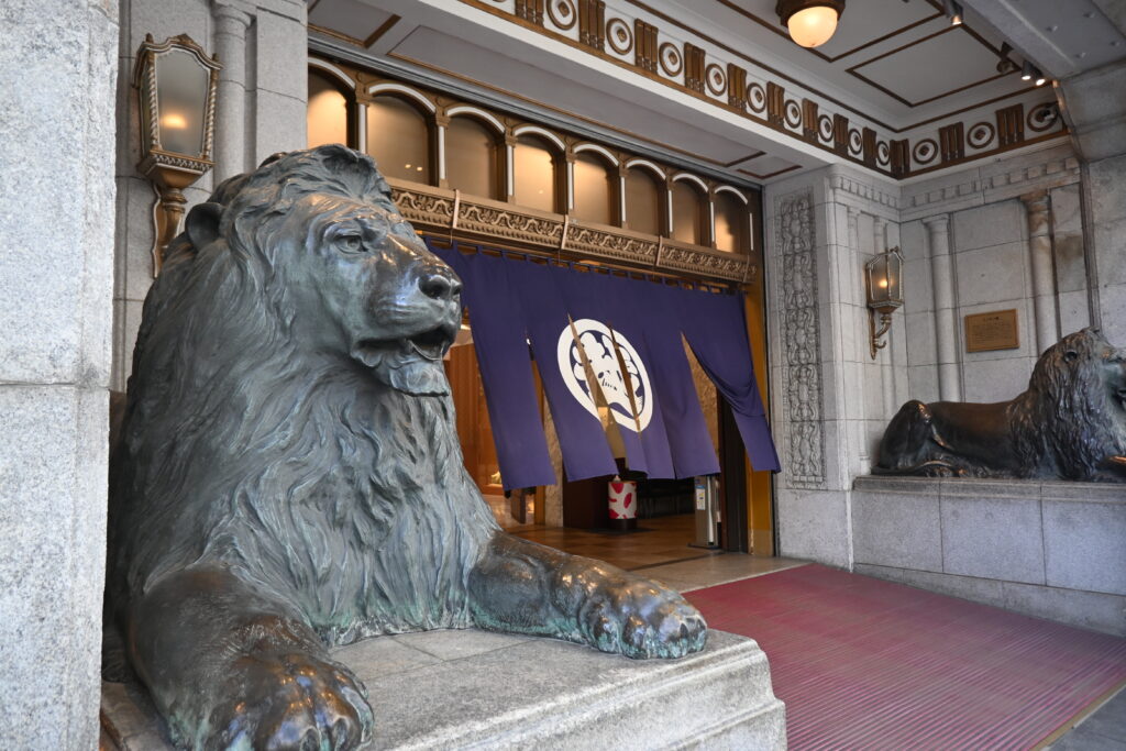
    In 1904 the store declared itself Japan’s first “department store”. Two bronze lions guard the main entrance. They were made in England in 1914, modeled on the lions of Trafalgar Square in London. If you are from Europe, they may look familiar.

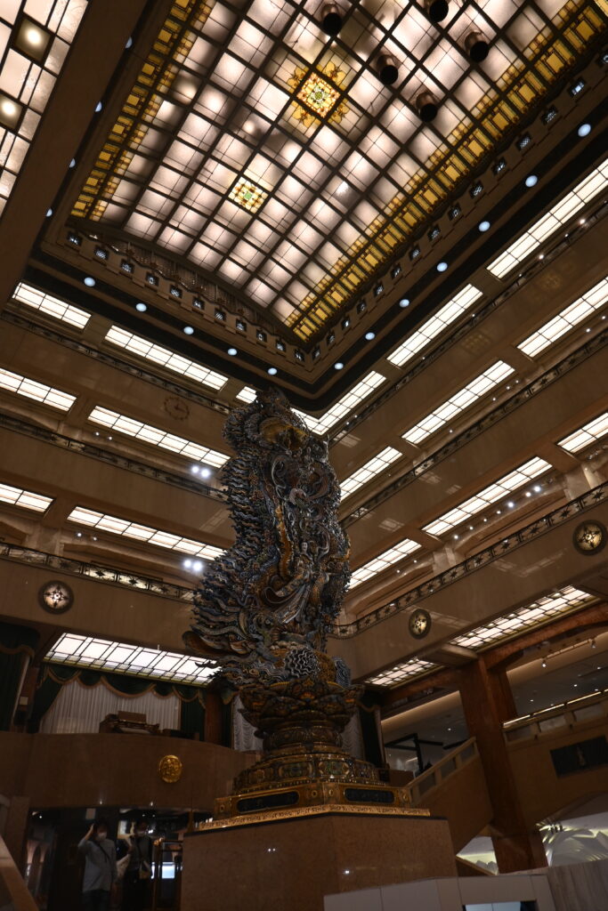
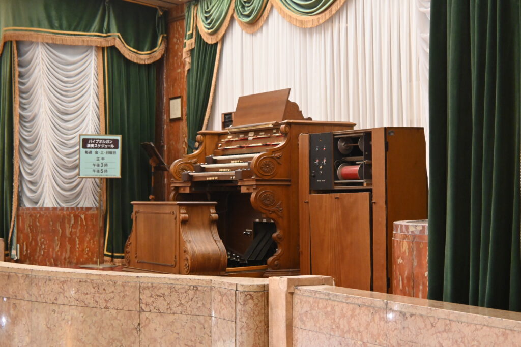
    Step inside. The central hall rises five floors, and in the middle stands a carved goddess, the Magokoro (Sincerity) statue, 10.9 meters tall, made by the sculptor Sato Gengen and installed in 1960. On the balcony above is a theater pipe organ, built by Wurlitzer in the United States and installed in 1930. It is still played on certain days, so check the store’s schedule if you want to hear it.

    COREDO Muromachi: old names, new buildings

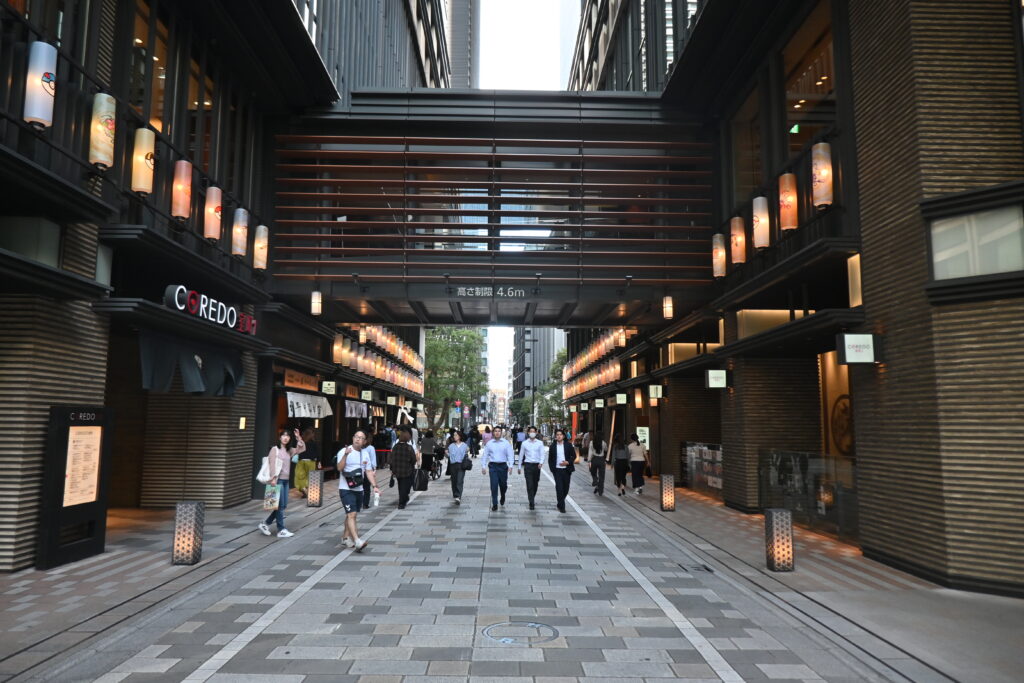
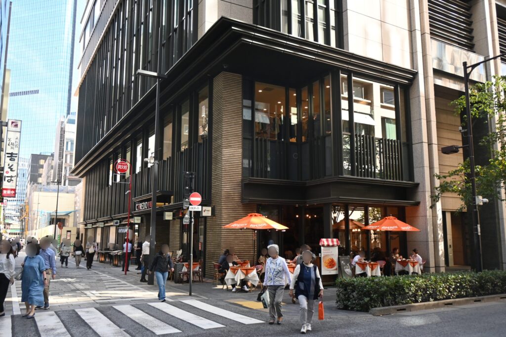
    Across the street, COREDO Muromachi is a group of new buildings designed to recall the old merchant town, with dark facades, shop curtains and lanterns. Inside are small shops of long-established Nihonbashi brands: knives, dried bonito, seaweed, Japanese paper. It is a good place for gifts and for lunch.

    Traveling with children? Nihonbashi is where the very first Pokémon Center opened in 1998. Today Pokémon Center Tokyo DX is on the 5th floor of the East Building of Nihonbashi Takashimaya S.C., a short walk south of the bridge (not in the main Takashimaya building).

    One more Hiroshige link: the street between Mitsukoshi and the Mitsui Main Building was once Surugacho, named because it pointed straight at Mount Fuji. Hiroshige painted it with Echigoya’s shop curtains on both sides and Fuji filling the end of the street. The street plan is still the same, but today you will not see Fuji through the buildings.

    The Bank of Japan, on the site of the gold mint

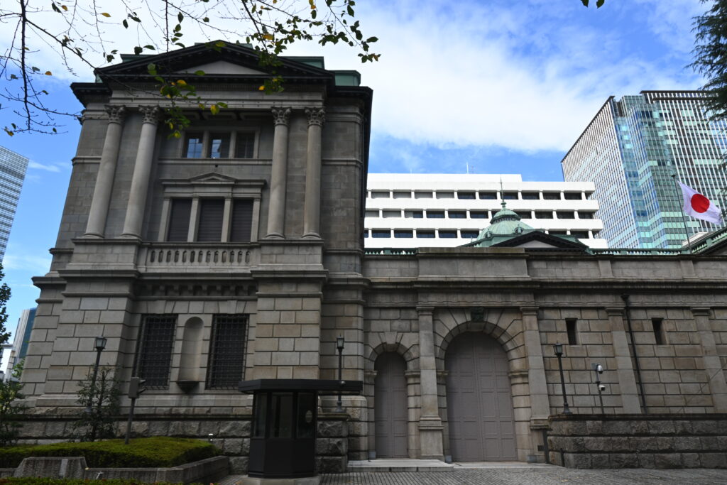
    A few minutes west is the Bank of Japan head office, completed in 1896 and designed by Tatsuno Kingo, the architect of Tokyo Station. The site was not chosen by chance: in the Edo period this was the Kinza, where the shogunate made its gold coins.

    You can join a free guided tour of the building, offered in English, if you book online in advance. Across the street, the Bank of Japan Currency Museum is free and shows Japanese money from ancient coins to modern notes (closed on Mondays).

    Three bridges called Tokiwabashi

    Walk to the river behind the bank and you find something unusual: three bridges with the same name, Tokiwabashi, side by side.

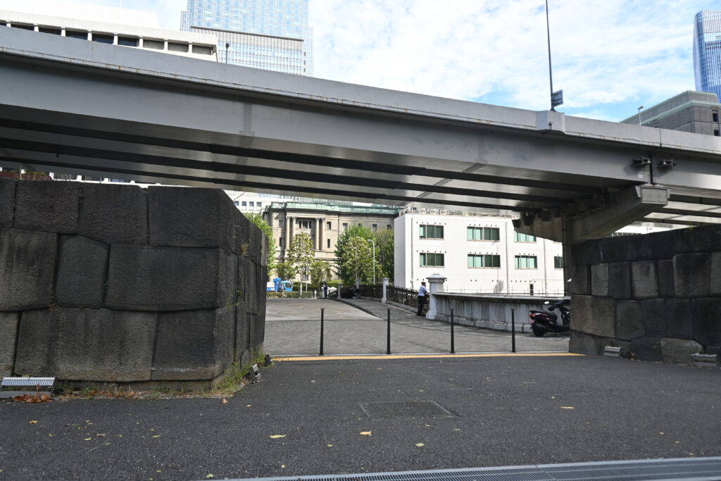
    Here stood Tokiwabashi Gate, one of the main gates of Edo Castle. It was also called the Asakusa Gate, because the road from here led to Asakusa and on to northern Japan. So if you came from Asakusa today, you followed the old road into the castle. The gate was taken down in 1873, but its stone walls survive and are a national historic site.

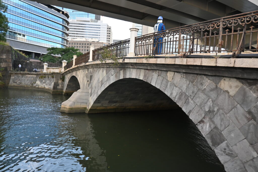
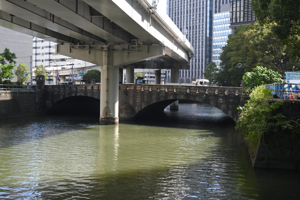
    The middle bridge is the stone Tokiwabashi of 1877, made with stones from another demolished castle gate. It is one of the oldest stone bridges in Tokyo. Downstream is a bridge from 1926, and upstream is a modern one from 1988: Meiji, Taisho and Showa, one after another.

    A small puzzle for kanji fans: the old stone bridge is written 常磐橋 and the 1926 bridge 常盤橋. Both are read “Tokiwabashi”. One popular story says the character 盤 (which contains “dish”) was changed to 磐 (“rock”) for the stone bridge, because a dish breaks easily. Look at the name posts and find the difference.

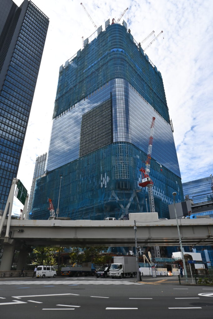
    Look up from the river, too. Right next door, in a new district that also houses the city’s sewage pumping station and office, a huge skyscraper is rising: Torch Tower, about 390 meters tall and planned to be the tallest building in Japan when it is completed in the late 2020s. From the stone walls of an Edo gate to Japan’s next tallest tower, all in one view: Tokyo is still rebuilding itself.

    Best time to go

    Weekday mornings are calm, and the light is good on the bridge before noon. Mitsukoshi opens at 10:00. If you want to tour the Bank of Japan, book a morning slot and do the walk around it.

    Good to know before you go

    • It is not a pretty postcard. The expressway makes the bridge dark and noisy. That is exactly the point of this walk, but do not expect a quiet old bridge.
    • Do not step into the road. The real road marker is in the traffic lanes. Even if the road looks empty, please do not cross to it for a closer look. Use the replica at the north end for photos.
    • The cruise is in Japanese. You can still enjoy the views, but you will not understand the commentary.
    • Plan the bank tour. The free Bank of Japan tours need an online reservation. The Currency Museum is closed on Mondays.
    • Toilets. Use Mitsukoshi or COREDO Muromachi.

    Getting there

    • From Shimbashi: Tokyo Metro Ginza Line to Nihonbashi, about 5 minutes, ¥180.
    • From Asakusa: Ginza Line directly to Mitsukoshimae or Nihonbashi, about 12 to 15 minutes, ¥180.
    • From Tokyo Station: walk about 10 minutes from the Nihonbashi Exit.

    Make a day of it

    Continue to Edo Castle with a guide

    Tokiwabashi Gate was the front door to Edo Castle, and the castle itself is only a short walk away. This two-hour walking tour with an English-speaking local guide explores the Imperial Palace grounds, the moats, gates and stone walls of Edo Castle and the story of the shoguns. It has very good reviews, many from European travelers, and free cancellation up to 24 hours before. Prices may change, so check the details and meeting point before you book.

    Where to stay

    Mandarin Oriental, Tokyo

    Why choose: A luxury hotel high in a tower a short walk from Mitsukoshi, with views over the city. You can step out of the lobby and start this walk at once.

    Mitsui Garden Hotel Nihonbashi Premier

    Why choose: A comfortable mid-range hotel within walking distance of the bridge, with easy Ginza Line access to Asakusa and Ginza.

    Next time

    Next time, we return to the Kengo Kuma series: a walk from Omotesando to Meiji Jingu, from the streets of Aoyama to the forest of the shrine.

    Photos: Aozora Walks unless otherwise noted. “Nihonbashi: Morning View” by Utagawa Hiroshige, from The Fifty-three Stations of the Tokaido: National Diet Library Digital Collections (public domain), https://dl.ndl.go.jp/pid/1309914.

  • Riding the Yurikamome Over Rainbow Bridge: Odaiba to Shimbashi on Tokyo’s Driverless Train

    Riding the Yurikamome Over Rainbow Bridge: Odaiba to Shimbashi on Tokyo’s Driverless Train

    This post contains affiliate links. If you book through them, I may earn a small commission at no extra cost to you.

    A train with no driver, running on rubber tires, climbing in a loop and gliding across Rainbow Bridge between an expressway and the sea. It sounds like a theme-park ride, but it is an ordinary commuter line: the Yurikamome.

    In Part 3, we sailed down the Sumida River from Asakusa to Odaiba by water bus. This time we take the other way home. As a geography teacher, I love this 15-minute ride because it shows how Tokyo built a whole new district on reclaimed land in the bay, and then had to squeeze a railway into it.

    Quick facts

    RouteOdaiba-kaihinkoen → Rainbow Bridge → Shibaura-futo → Shiodome → Shimbashi
    TimeAbout 13 minutes
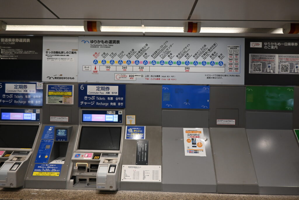
    Fare¥325 with an IC card / ¥330 ticket (adults)
    PaymentSuica, PASMO and other IC cards, or contactless credit cards and phones
    Best seatThe very front, or the very back for photos

    A driverless train on rubber tires

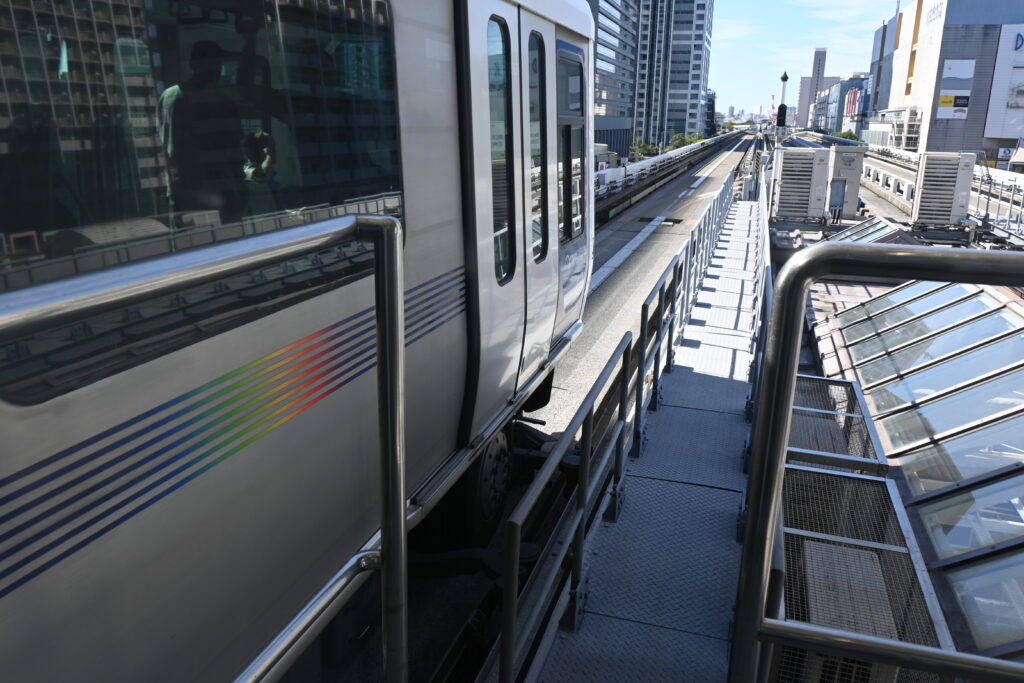
    The Yurikamome is not a normal train. It is a “new transit system”: small, computer-controlled cars that run on rubber tires along a concrete guideway, with no driver and no conductor on board. The whole line runs on an elevated track, so you are above the streets for the entire ride.

    Rubber tires grip better than steel wheels on rails, so the Yurikamome can handle steep slopes and sharp curves. That matters here. The line was built after the roads and expressways around it, so it had to weave over, under and between them. The result is a ride with surprising climbs, drops and turns that you will not find on most railways.

    There is a story behind it, too. The line opened in November 1995, planned for the World City Expo that Tokyo was to host on this waterfront in 1996. The expo was cancelled during construction, and for a while the new trains ran through almost empty reclaimed land. In Odaiba, the railway came before the city.
    Then and now: Odaiba was once the sea

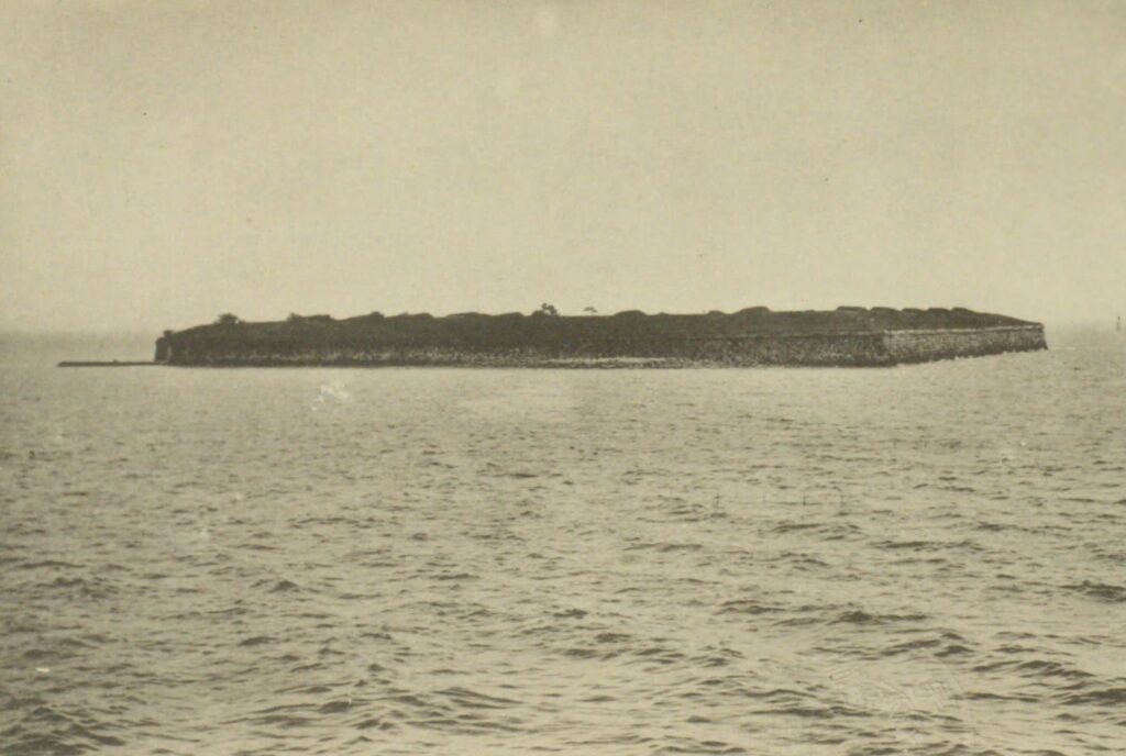
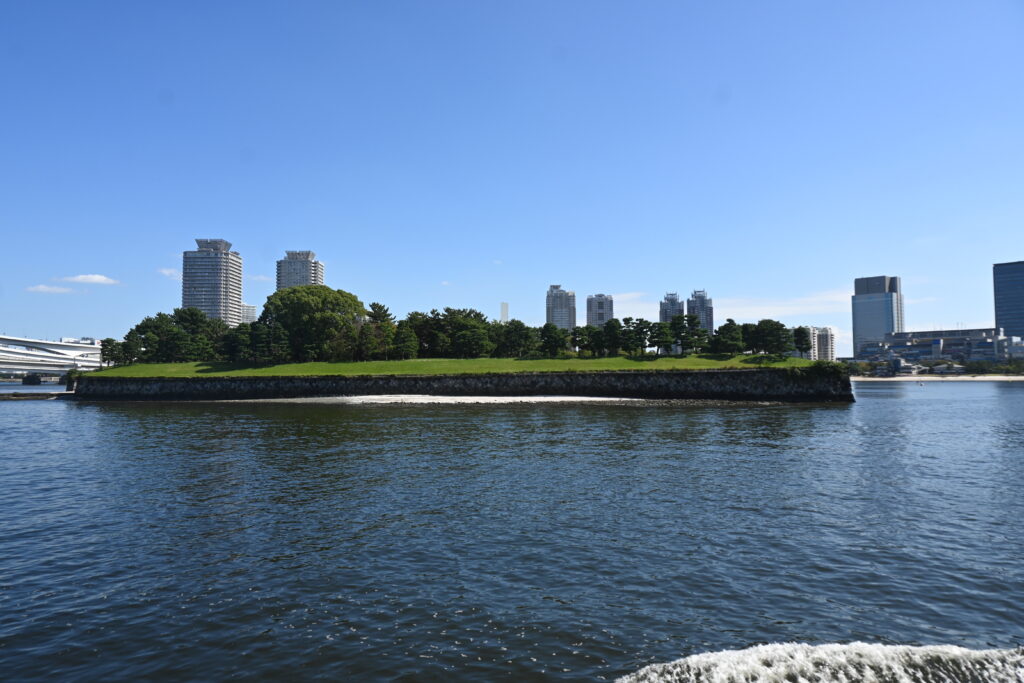
    Where did the name “Odaiba” come from? In 1853, American warships under Commodore Perry sailed into Edo Bay, and the shogunate hurried to build a line of small island forts, called daiba, in the sea off Shinagawa to defend the city. Only two of them survive today: No. 3, now Daiba Park, and No. 6, an overgrown island you can see from the bridge. The whole Odaiba district, and the name itself, grew from these forts.

    What stayed the same: the stone walls. The low, angled walls of the fort are the same ones you can see in the 1927 photograph, built more than 170 years ago.

    What changed: everything around them. In 1927 the fort sat alone in open water, with nothing but sea and sky behind it. Today pine trees and grass cover the top, a sandy beach runs beside it, and the high-rises of Odaiba stand where there was once only sea. The Yurikamome you are about to ride runs across land that did not exist a century ago.

    Daiba Park, on top of the No. 3 fort, is free and open at all times, about a 20-minute walk along the beach from Odaiba-kaihinkoen Station. If you have time before your train, walk along the old stone walls.

    Starting at Odaiba-kaihinkoen

    If you arrived by water bus, walk inland from the pier to Odaiba-kaihinkoen Station. There are coin lockers by the ticket gates, handy if you are carrying shopping bags or luggage.

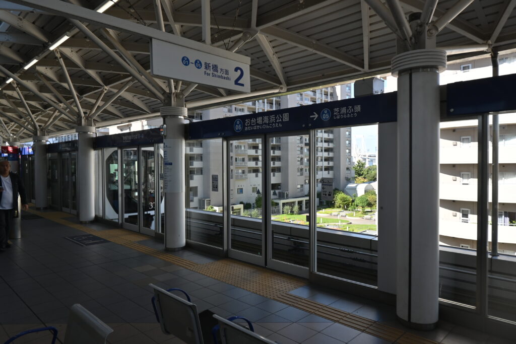
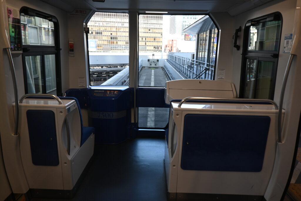
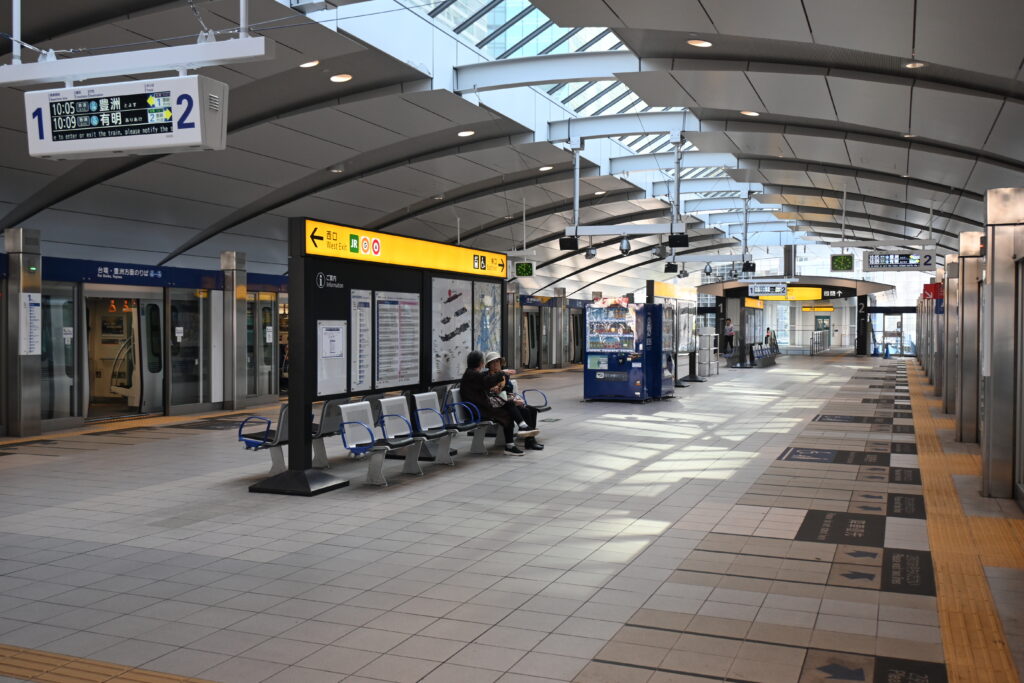
    Platforms have screen doors, and trains come every few minutes. Here is the fun part: with no driver’s cab, the front of the train is just a big window with seats behind it.

    Crossing Rainbow Bridge

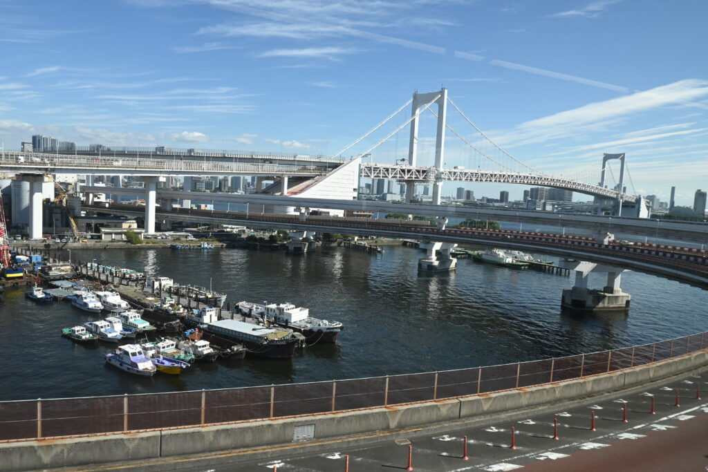
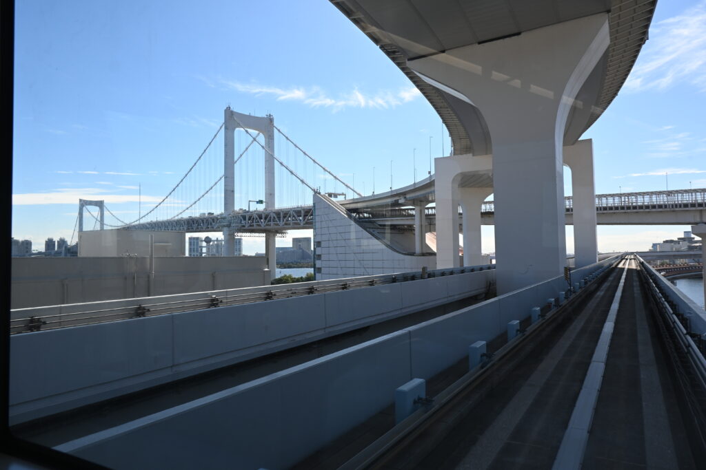
    Soon after leaving Odaiba-kaihinkoen, the train heads onto Rainbow Bridge. This is a two-level bridge. The Yurikamome runs down the middle of the lower deck, with the Shuto Expressway directly above you and ordinary road lanes on both sides at the same level. The track is wrapped in mesh, so it feels like riding through a tube in a science-fiction film. On a clear day, the white towers stand out sharply against the blue sky.

    At the Shibaura end, the train swings around a big loop. The bridge deck is high above the water so that ships can pass underneath, and the loop is how the track and the road climb up to it, and back down, in the little space available on the shore.

    You can walk across it, too!

    Rainbow Bridge has free walkways, the Rainbow Promenade, on the outer edges of the lower deck. The walk is about 1.7 km and takes around 30 minutes between the Shibaura side and the Odaiba side. You choose the north route (views of Tokyo Tower, Tokyo Skytree and the city) or the south route (views of Odaiba and the old Daiba fort) at the entrance, and you cannot switch halfway. One fun plan: walk across one way and ride the Yurikamome back.

    • Open 9:00–21:00 from April to October, and 10:00–18:00 from November to March. Last entry 30 minutes before closing.
    • Closed on the third Monday of each month (the next day if it is a holiday).
    • No cycling, no tripods. Pets and folding bikes are allowed only if carried in a bag.
    • The Shibaura entrance is about 5 minutes from Shibaura-futo Station; the Odaiba side is about 10 minutes from Odaiba-kaihinkoen Station.

    Between the skyscrapers

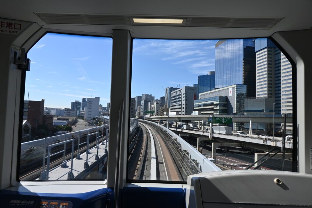
    After Shibaura-futo, the line curves north toward Shimbashi, and this is where the “roller coaster” feeling kicks in. The track dips, rises and bends between office towers, sometimes so close that you can almost look into the windows.

    Tip: front for the thrill, back for the photos

    Because there is no driver, the last car has the same big window as the first. I took most of the photos in this article from the very back, and I think the back is actually better for photos. But both ends have great views, and the front is more exciting, especially for kids.

    Arriving at Shimbashi

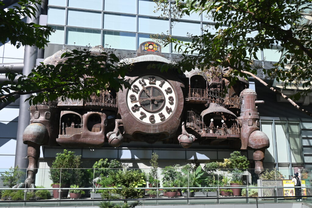
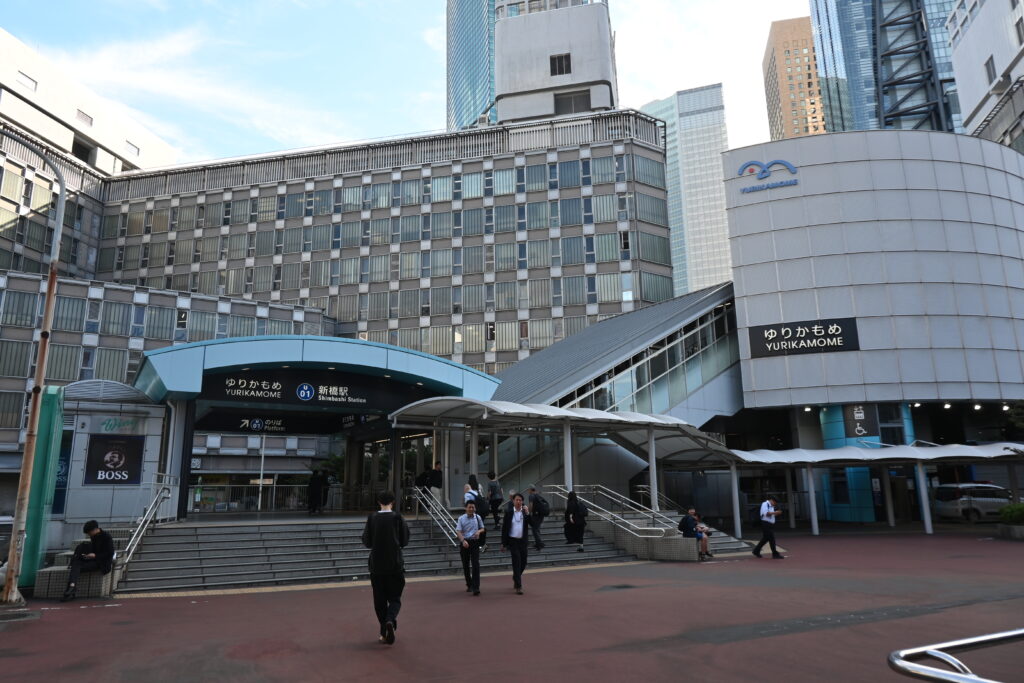
    The line ends at Shimbashi, one of Tokyo’s busiest business districts. Just before you arrive, look for the Shiodome skyscrapers. Outside the Nippon TV building at Shiodome stands a giant clock designed by Hayao Miyazaki, the director of Spirited Away and My Neighbor Totoro. It “performs” several times a day.

    From Shimbashi, you can change to the JR lines, the Toei Asakusa Line, or the Ginza Line. The Ginza Line takes you straight back to Asakusa, or to Nihonbashi for our next walk.

    Best time to go

    • Weekday daytime is the easiest time to get a front seat.
    • Weekends, school holidays (especially spring and summer), and big event days at Tokyo Big Sight are very crowded.
    • Go in clear weather if you can: the views of the bay and the white towers of Rainbow Bridge are at their best.

    Good to know before you go

    • Check for events. When Tokyo Big Sight or other Odaiba venues hold a big event, the Yurikamome can be packed. Check the Tokyo Big Sight event calendar before you go.
    • Want the front seat? Wait for two trains. Shimbashi and Toyosu, the two ends of the line, have only two tracks each. Let the train waiting at your platform leave, then the one from the other track, and you will be at the head of the line for the front seats on the next train. It works every time, even when it is busy.
    • Check the direction. At the end stations, trains reverse and leave in the direction they came from. Make sure you are on the right platform.
    • Paying the fare. You can tap an IC card such as Suica, or a contactless credit card or phone at the gate. With contactless cards, the total fare for one day is capped at ¥820 (same card and same device). The old magnetic one-day pass is no longer sold. Check the official Yurikamome website for the latest details.

    Tip: you will need mobile data for route searches, and some contactless payments use your phone. An eSIM is the easiest option for visitors.

    Getting there

    • From Odaiba: Yurikamome Odaiba-kaihinkoen Station, about 13 minutes to Shimbashi.
    • From the water bus: walk from Odaiba Seaside Park pier to Odaiba-kaihinkoen Station.
    • From Shimbashi: JR, Tokyo Metro Ginza Line and Toei Asakusa Line all connect.

    Make a day of it

    teamLab Planets

    If you have more time, stay on the Yurikamome the other way, toward Toyosu. Near Shin-Toyosu Station is teamLab Planets, an immersive digital art museum where you walk barefoot through rooms of light, mirrors and water.

    This ticket on GetYourGuide is the official entry ticket, with timed entry. Same-day booking is not possible, tickets are non-refundable, and you must enter within 30 minutes of your time slot. Prices may change and may differ from the official site, so compare before you book.

    Where to stay

    Hilton Tokyo Odaiba

    Why choose: A bayside hotel next to Daiba Station on the Yurikamome, close to Rainbow Bridge and the Odaiba waterfront.

    Grand Nikko Tokyo Daiba

    Why choose: A large hotel by Daiba Station, convenient for exploring Odaiba and riding the Yurikamome in the quiet morning hours.

    Park Hotel Tokyo

    Why choose: In the Shiodome skyscrapers at the Shimbashi end of the line, with easy access to Ginza and the Ginza Line.

    Next time

    From Shimbashi, we take the Ginza Line to Nihonbashi, the bridge where all of Japan’s old highways began. Stone bridges, a department store with a giant goddess, and an expressway that will soon disappear: Tokyo’s past and future, side by side.

    Photos: Aozora Walks unless otherwise noted. The No. 3 Daiba fort in 1927: “Shinagawa Daiba” (Tokyo City Parks Division, 1927), National Diet Library Digital Collections (public domain).

  • From Asakusa to Odaiba by Water Bus: Reading Tokyo’s History Under the Sumida River Bridges

    From Asakusa to Odaiba by Water Bus: Reading Tokyo’s History Under the Sumida River Bridges

    This post contains affiliate links. If you book through them, I may earn a small commission at no extra cost to you.

    Imagine stepping aboard a silver spaceship in Asakusa and sailing back into the Edo period.

    That is what a water bus ride down the Sumida River feels like. The boat looks as if it came straight out of a science-fiction comic, yet the river beneath it was the great highway of old Edo. For centuries, boats carried rice, timber and travelers along this river, and its bridges were where the city gathered, celebrated and, at times, fled from disaster.

    In Part 1 and Part 2, we explored the streets of old Asakusa through the eyes of Demon Slayer. This time, as promised, we take to the water. As a geography teacher, I think this one-hour trip from Asakusa to Odaiba is one of the best ways to see how Tokyo grew, from a city of wooden bridges to a waterfront of steel and glass.

    Quick facts

    SceneSumida River and Tokyo Bay by water bus
    RouteAsakusa Pier → down the Sumida River → under Rainbow Bridge → Odaiba Seaside Park
    Fare¥2,000 adults / ¥1,000 children (Emeraldas, direct)
    TimeAbout 55 minutes by timetable (my boat arrived in about 40)
    Nearest stationAsakusa Station (Ginza Line / Asakusa Line Exit 4, 1 min walk)

    Finding the pier

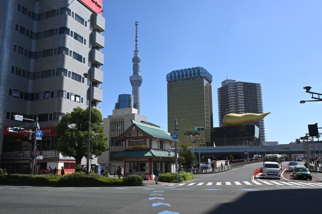
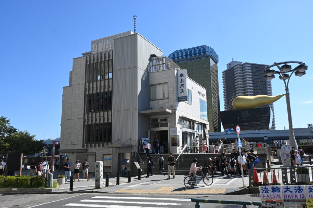
    From Kaminarimon Gate, walk a few minutes toward the Sumida River, the side where you can see Tokyo Skytree. Next to Azumabashi Bridge, just behind the small Japanese-style police box, you will find the ticket building with “TOKYO CRUISE” written on it.

    Buy your ticket first, then explore

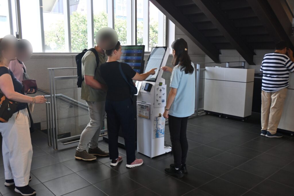
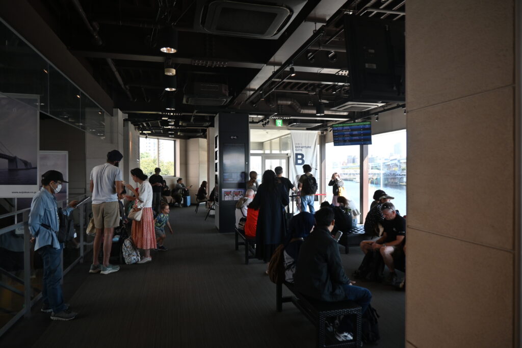
    There are ticket machines inside, but there is almost always a queue, and departures leaving soon often sell out. There seem to be many boats, but they go to several destinations. Only about six a day sail directly to Odaiba, so if you miss the one you want, you may wait two hours or more.

    My advice: buy your ticket first, then walk back to Senso-ji until departure time. Even better, book online in advance.

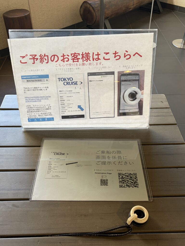
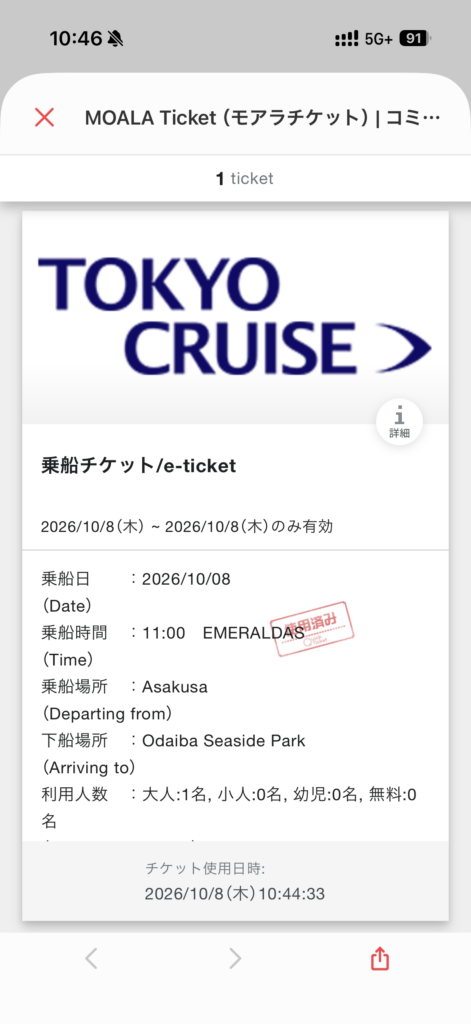
    If you book online, your e-ticket arrives by email and opens on your phone. On the way to the boarding gate, you will find a small check-in device shaped a bit like a rubber stamp. You simply press it onto your phone screen, and the ticket is marked as used. I had never seen a system like this before.

    Tip: you will need mobile data to open your e-ticket at the pier. An eSIM such as Airalo is the easiest option for visitors.

    On board the Emeraldas

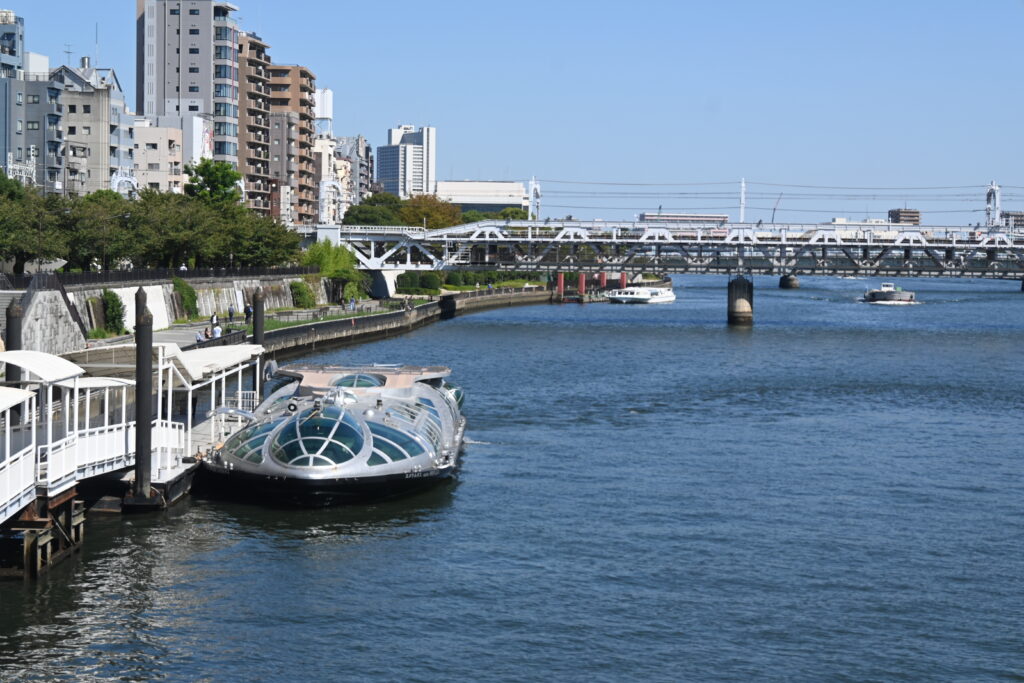
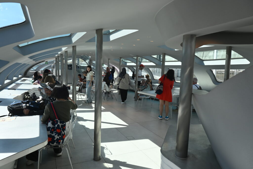
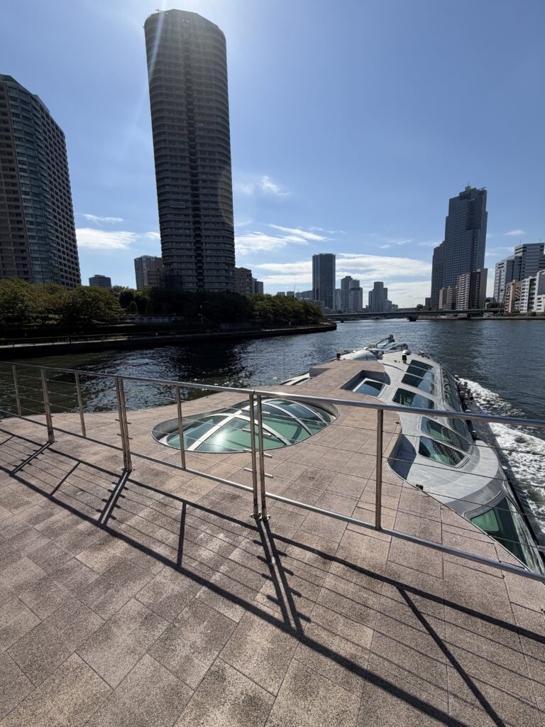
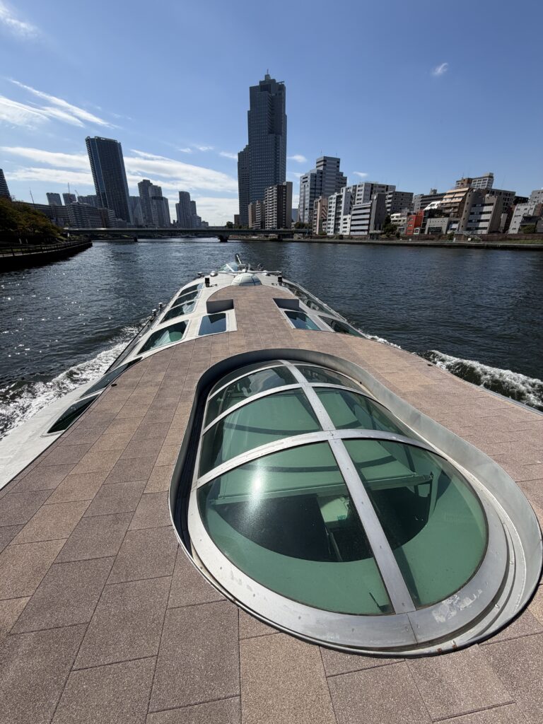
    I rode the Emeraldas. Its silver, spaceship-like exterior was designed by Leiji Matsumoto, the manga artist famous for Galaxy Express 999. The interior is by the architect Takato Tamagami, who made the front cabin feel like a riverbank, with curving benches and counters instead of rows of seats.

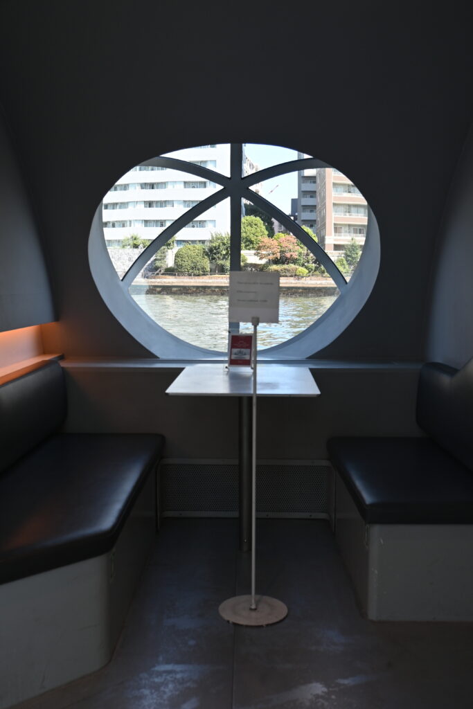
    There is plenty of seating, so you will not have to stand. If you want a table or a window seat, though, join the line at the gate about 15 minutes before departure. The Emeraldas also has three private compartments, available for an extra charge of roughly ¥3,000–4,000. Check availability when you book.

    You are welcome to bring food and drinks on board. Pick something up at a convenience store or fast-food shop near the pier and enjoy a picnic on the river. The cabin is air-conditioned and mostly enclosed, so the trip is comfortable in both summer and winter.

    The rooftop deck opens once the crew have it ready, usually some time after departure. Up there you are much closer to the bridges and the view is wider. In spring and autumn it is wonderful.

    Under the bridges

    Between Asakusa and Tokyo Bay, the boat passes under more than ten bridges, and you get to see their undersides, which you would never notice from the street. Each one has a different shape and structure, and many carry a story about how Tokyo grew. Three stood out for me.

    Ryogoku Bridge: born from a great fire

    In the early Edo period, the shogunate allowed only one bridge across this river, for defense. In 1657, the Great Meireki Fire swept through Edo. With no way across the river, huge numbers of people were trapped, and the death toll is said to have reached around 100,000.

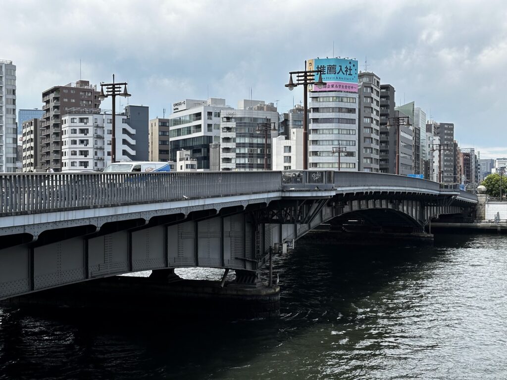
    Ryogoku Bridge was built soon afterward, in 1659 (some sources say 1661), as an escape route. Its name, “Bridge of Two Provinces,” comes from the river once marking the border between Musashi and Shimousa provinces. Open spaces were cleared at both ends to stop fires from spreading. These firebreaks soon filled with food stalls and street shows, and became one of Edo’s liveliest entertainment districts.

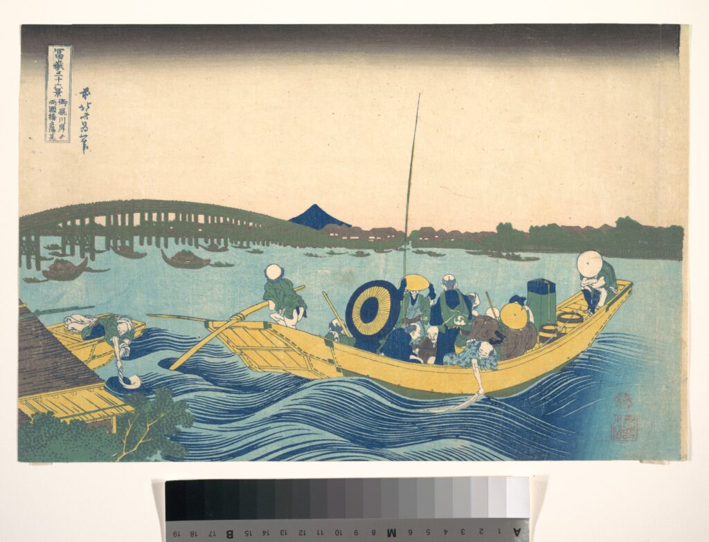
    Katsushika Hokusai, the artist of The Great Wave, also painted this spot. In his series Thirty-six Views of Mount Fuji, a crowded ferry crosses the river at sunset, with Ryogoku Bridge stretching behind it and Mount Fuji on the horizon. The ferry is long gone, but you are floating on the same river.

    Shin-Ohashi Bridge: the bridge Van Gogh painted

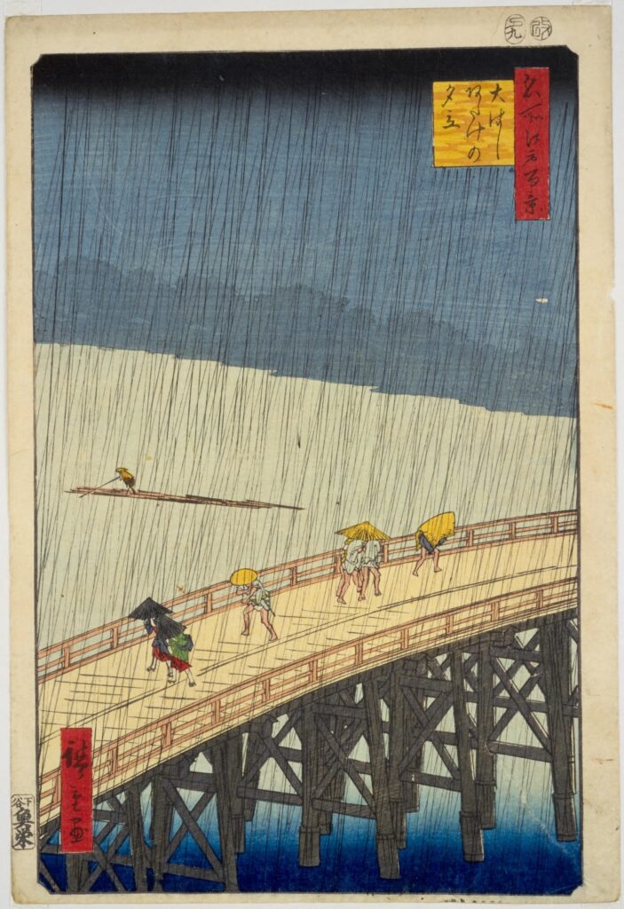
    Soon after Ryogoku comes Shin-Ohashi Bridge. In 1857, Utagawa Hiroshige depicted the bridge in a sudden summer shower in his series One Hundred Famous Views of Edo. Thirty years later in Paris, Vincent van Gogh was so taken with the print that he made his own painted copy, Bridge in the Rain (after Hiroshige). The bridge you pass under today is a modern one, but the river view is the one that crossed the world.

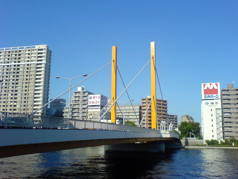
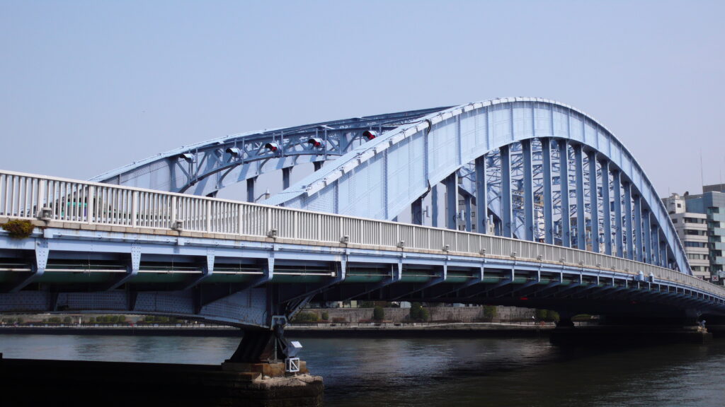
    Further downstream, look out for Kiyosu and Eitai Bridges. Both were built after the Great Kanto Earthquake of 1923 destroyed much of the city, and both were modeled on bridges over the Rhine in Germany. First a great fire, then a great earthquake: Tokyo has rebuilt itself again and again, and you can read that history in its bridges.

    Kachidoki Bridge: a gate to the sea

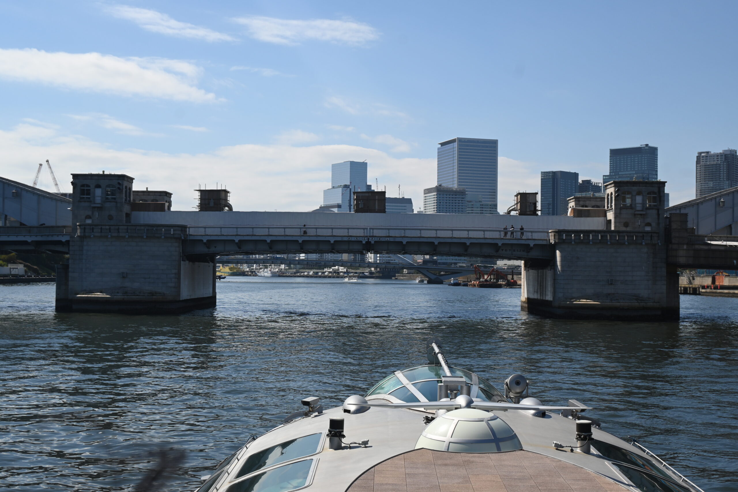
    Kachidoki Bridge felt different from the moment it came into view. Two massive steel arches stand on either side of the river, with heavy stone piers between them, like a great gate guarding the way to the sea. Its name, meaning “a shout of victory,” comes from a ferry that once crossed here, named in 1905 after a victory in the Russo-Japanese War. And the gate-like look is no accident: the bridge was planned as a grand entrance for an international exposition scheduled for 1940, which was never held.

    Kachidoki is also a bascule bridge. Its center once split in two and rose like a pair of wings to let large ships pass, about five times a day at its peak. As river traffic fell and car traffic grew, it opened for the last time in 1970. When you pass beneath it, look closely at the middle of the deck. You can still see the seam where the two halves were meant to part. It was one of my favorite moments of the trip. In 2007, the bridge was designated an Important Cultural Property of Japan.

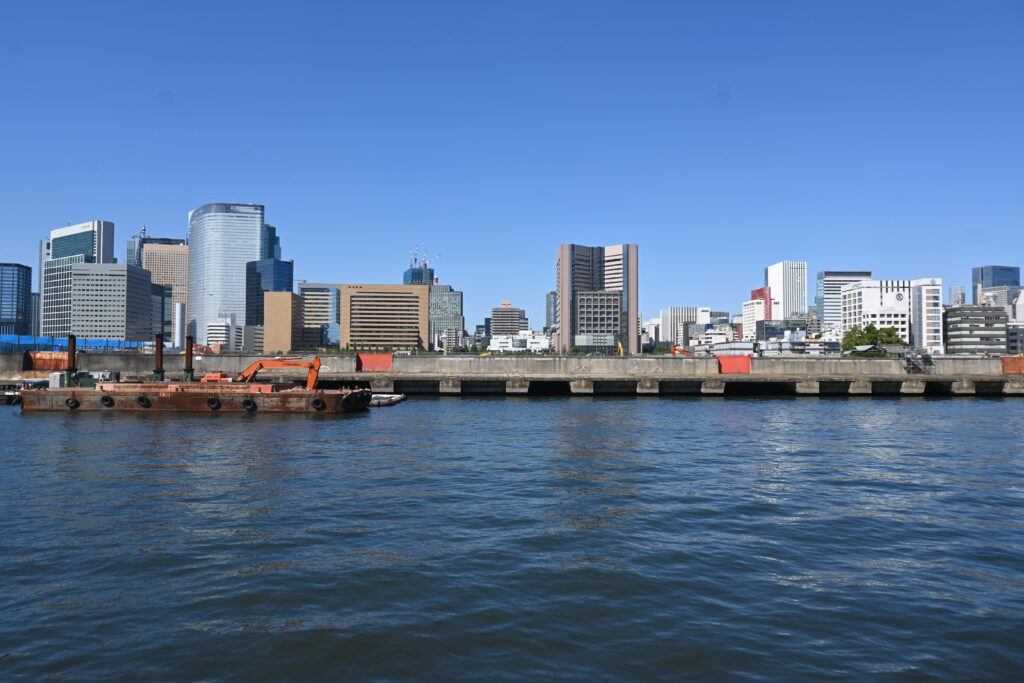
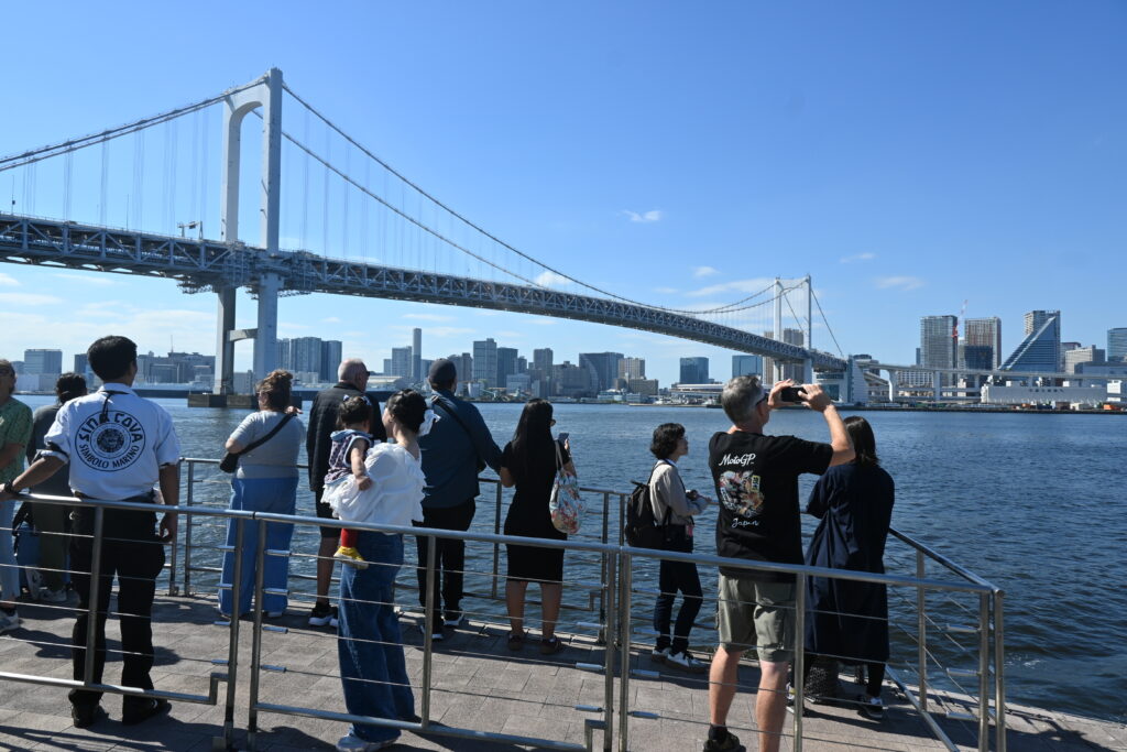
    Just past Kachidoki, work is beginning on the former site of the Tsukiji fish market, which moved to Toyosu in 2018. A large stadium and a new waterfront district are planned there for the 2030s. Then the river opens into Tokyo Bay, and the boat slips under Rainbow Bridge on its final approach to Odaiba.

    Arriving in Odaiba: an architect’s skyline

    As you approach Odaiba Seaside Park, look for the building with a giant silver sphere. This is the Fuji TV headquarters, completed in 1996 and designed by Kenzo Tange. He was one of Japan’s greatest architects and won the Pritzker Prize. His other works include the Tokyo Metropolitan Government Building and St. Mary’s Cathedral in Tokyo.

    And here is a nice coincidence. Right across from Kaminarimon, where this trip began, stands the Asakusa Culture Tourist Information Center, designed by Kengo Kuma, the architect of Japan’s National Stadium. Two generations of Japanese architecture bookend a single boat ride.

    Another option: the Tokyo Mizube Line

    TOKYO CRUISE is not the only way to sail from Asakusa to Odaiba. The Tokyo Mizube Line, run by the Tokyo Metropolitan Park Association, also connects the two. Its old boats were retired in January 2026, and service resumes on 17 October 2026 with a new boat, the Raiden.

    Here is the interesting part. The Raiden is a disaster-response vessel built by the Tokyo Metropolitan Government. In an emergency, it carries supplies and people along the rivers. On ordinary days, it carries sightseers like you. After a trip past bridges born from fires and earthquakes, that feels like a fitting end to the story.

    • Pier: Nitenmon Pier, about a 5-minute walk upstream (north) from the TOKYO CRUISE pier
    • Route: Nitenmon → Ryogoku (short stop) → Odaiba Seaside Park, about 65 minutes
    • Departures: 10:40, 13:20 and 16:00 from Nitenmon, mainly Wednesday to Sunday
    • Fare: ¥2,000 adults / ¥1,000 children

    It is far less known among visitors, so it is usually much less crowded. The trade-off is fewer departures, so check the official timetable before you go.

    Good to know before you go

    • Book ahead. Direct boats to Odaiba are limited, and same-day tickets often sell out.
    • Arrive early for good seats. Join the line about 15 minutes before departure.
    • Bring snacks. Food and drinks are allowed on board.
    • Check the weather. Boats can be cancelled in bad weather, and the rooftop deck opens only when conditions allow.
    • Maintenance days. Each boat has regular days off for maintenance, so check the timetable for your date.
    • Two operators, two piers. TOKYO CRUISE and the Tokyo Mizube Line leave from different piers. Make sure you go to the right one.

    Getting there

    • TOKYO CRUISE Asakusa Pier: 1 minute on foot from Exit 4 of Asakusa Station (Tokyo Metro Ginza Line and Toei Asakusa Line) and from the Tobu Line station
    • From Odaiba Seaside Park, the Yurikamome line takes you back to central Tokyo across Rainbow Bridge. Here is how to ride it, and how to get the front seat.

    Book your trip

    Book directly with TOKYO CRUISE

    The simplest option is to book your seat on the official TOKYO CRUISE website, which has an English page. You pay only the regular fare, and your e-ticket arrives by email.

    Water bus tickets are also sold on GetYourGuide. Note that this ticket is sold by a travel agency, not by TOKYO CRUISE itself. You cannot choose your boat, so you may not ride the Emeraldas, and you board with a special link sent the day before rather than your booking number. Prices and conditions may change, so compare with the official site before you book. For most visitors, booking directly is simpler.

    Explore Asakusa before you sail

    The pier is only a few minutes from Senso-ji, so if you have time before your boat, see the temple district with a guide first. This two-hour walking tour with an English-speaking guide starts beside Kaminarimon and takes you along Nakamise Street to Senso-ji and into the back streets, with some street food along the way. Prices may change, so check the details before you book.

    Prefer a guide?

    If you would like someone to explain the sights as you go, this private tour with a government-licensed, English-speaking guide combines a water bus ride with three or four stops of your choice, such as Senso-ji, Ryogoku Kokugikan, Hamarikyu Gardens and Odaiba. It takes about six hours, and only your own group joins.

    Where to stay

    Hotel Gracery Asakusa

    Why choose: About 200 meters from Kaminarimon and a 3-minute walk from Asakusa Station. You can walk to the pier in minutes, and Senso-ji is right on your doorstep for an early-morning visit before the crowds arrive.

    THE GATE HOTEL Ryogoku by HULIC

    Why choose: A riverside hotel in Ryogoku, a little away from Asakusa but right on the theme of this trip. It stands on the Sumida River near Ryogoku Bridge, about a minute’s walk from the Ryogoku pier used by the Tokyo Mizube Line. Some rooms look out over the river or the Ryogoku Kokugikan sumo arena, and the guest-only terrace on the 9th floor has views of the river and Tokyo Skytree.

    KOKO HOTEL Residence Asakusa Tawaramachi

    Why choose: A 2-minute walk from Tawaramachi Station on the Ginza Line, one stop from Asakusa and a direct ride to Ueno and Ginza. Rooms come with a kitchen and a washer-dryer and sleep up to six, which makes it a good base for families and longer stays.

    Next time

    Heading back? Ride the Yurikamome over Rainbow Bridge from Odaiba to Shimbashi. Before you board, look out for the old stone fort that gave Odaiba its name.

    This trip ended with two great architects, Kenzo Tange and Kengo Kuma. In the next series, we will look at their buildings more closely and explore how modern Japanese architecture shaped the Tokyo skyline.

    Photos: Aozora Walks unless otherwise noted. Ryogoku Bridge: Ryu ohsako / Wikimedia Commons, CC BY-SA 4.0. Shin-Ohashi Bridge: Jmho / Wikimedia Commons (public domain). Eitai Bridge: jmho / Wikimedia Commons (public domain). Katsushika Hokusai print: The Metropolitan Museum of Art (CC0). Utagawa Hiroshige print: National Diet Library Digital Collections (public domain).